

Aliso Creek Trail to Monarch Beach
A cycling route starting in Portola Hills, California, United States.
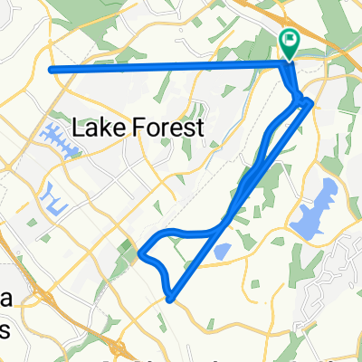
Overview
About this route
- -:--
- Duration
- 32.9 km
- Distance
- 211 m
- Ascent
- 534 m
- Descent
- ---
- Avg. speed
- ---
- Max. altitude

Route quality
Waytypes & surfaces along the route
Waytypes
Cycleway
23.7 km
(72 %)
Road
5.3 km
(16 %)
Surfaces
Paved
29.6 km
(90 %)
Unpaved
0.3 km
(1 %)
Asphalt
18.1 km
(55 %)
Paved (undefined)
8.9 km
(27 %)
Route highlights
Points of interest along the route
Point of interest after 0.2 km
Cooks Corner
Continue with Bikemap
Use, edit, or download this cycling route
You would like to ride Aliso Creek Trail to Monarch Beach or customize it for your own trip? Here is what you can do with this Bikemap route:
Free features
- Save this route as favorite or in collections
- Copy & plan your own version of this route
- Sync your route with Garmin or Wahoo
Premium features
Free trial for 3 days, or one-time payment. More about Bikemap Premium.
- Navigate this route on iOS & Android
- Export a GPX / KML file of this route
- Create your custom printout (try it for free)
- Download this route for offline navigation
Discover more Premium features.
Get Bikemap PremiumFrom our community
Other popular routes starting in Portola Hills
 50 mile portola hills
- Distance
- 79 km
- Ascent
- 631 m
- Descent
- 633 m
- Location
- Portola Hills, California, United States
 Laguna Niguel Regional Park
- Distance
- 20.1 km
- Ascent
- 61 m
- Descent
- 342 m
- Location
- Portola Hills, California, United States
 De El Toro Road 20702, Mission Viejo a Pheasant Creek 164, Lake Forest
- Distance
- 13.1 km
- Ascent
- 0 m
- Descent
- 0 m
- Location
- Portola Hills, California, United States
 Home Cooks to Bake
- Distance
- 12.3 km
- Ascent
- 41 m
- Descent
- 258 m
- Location
- Portola Hills, California, United States
 De Pheasant Creek 164, Lake Forest a El Toro Road 20702, Mission Viejo
- Distance
- 24.6 km
- Ascent
- 0 m
- Descent
- 0 m
- Location
- Portola Hills, California, United States
 Aliso Creek Bikeway to Wood Canyon
- Distance
- 22.9 km
- Ascent
- 31 m
- Descent
- 261 m
- Location
- Portola Hills, California, United States
 De El Toro Road 20702, Mission Viejo a California 1 32880, Dana Point
- Distance
- 24.2 km
- Ascent
- 2 m
- Descent
- 0 m
- Location
- Portola Hills, California, United States
 De El Toro Road 20702, Mission Viejo a Pheasant Creek 164, Lake Forest
- Distance
- 24.7 km
- Ascent
- 2 m
- Descent
- 10 m
- Location
- Portola Hills, California, United States
Open it in the app