

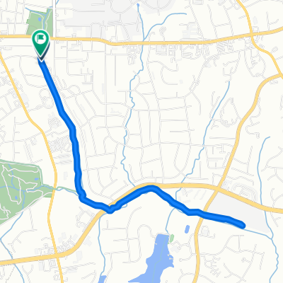
Recovered Route
A cycling route starting in Gastonia, North Carolina, United States.
Overview
About this route
- 35 min
- Duration
- 11.8 km
- Distance
- 90 m
- Ascent
- 99 m
- Descent
- 20.3 km/h
- Avg. speed
- ---
- Max. altitude
Route quality
Waytypes & surfaces along the route
Waytypes
Busy road
4.7 km
(40 %)
Quiet road
4.1 km
(35 %)
Surfaces
Paved
2.5 km
(21 %)
Asphalt
2.5 km
(21 %)
Undefined
9.3 km
(79 %)
Continue with Bikemap
Use, edit, or download this cycling route
You would like to ride Recovered Route or customize it for your own trip? Here is what you can do with this Bikemap route:
Free features
- Save this route as favorite or in collections
- Copy & plan your own version of this route
- Sync your route with Garmin or Wahoo
Premium features
Free trial for 3 days, or one-time payment. More about Bikemap Premium.
- Navigate this route on iOS & Android
- Export a GPX / KML file of this route
- Create your custom printout (try it for free)
- Download this route for offline navigation
Discover more Premium features.
Get Bikemap PremiumFrom our community
Other popular routes starting in Gastonia
 1200 East Dr, Gastonia to 2212 Union Rd, Gastonia
- Distance
- 6 km
- Ascent
- 10 m
- Descent
- 30 m
- Location
- Gastonia, North Carolina, United States
 1525 S Marietta St, Gastonia to 1930 Hartford Dr, Gastonia
- Distance
- 2.9 km
- Ascent
- 16 m
- Descent
- 45 m
- Location
- Gastonia, North Carolina, United States
 E Eighth Ave, Gastonia to S Chestnut St, Gastonia
- Distance
- 7.4 km
- Ascent
- 38 m
- Descent
- 38 m
- Location
- Gastonia, North Carolina, United States
 Lynhurst Drive 1236, Gastonia to Lynhurst Drive 1236, Gastonia
- Distance
- 7.7 km
- Ascent
- 27 m
- Descent
- 36 m
- Location
- Gastonia, North Carolina, United States
 1222–1298 S Marietta St, Gastonia to 1942 Robinwood Rd, Gastonia
- Distance
- 3.8 km
- Ascent
- 30 m
- Descent
- 34 m
- Location
- Gastonia, North Carolina, United States
 Lynhurst Drive 1230, Gastonia to Lynhurst Drive 1257, Gastonia
- Distance
- 16.4 km
- Ascent
- 135 m
- Descent
- 132 m
- Location
- Gastonia, North Carolina, United States
 1812 Westbrook Cir, Gastonia to S Cherokee St, Kings Mountain
- Distance
- 20.4 km
- Ascent
- 191 m
- Descent
- 129 m
- Location
- Gastonia, North Carolina, United States
 240 W Franklin Blvd, Gastonia to 56 Allen St, Dawsonville
- Distance
- 329.8 km
- Ascent
- 3,952 m
- Descent
- 3,773 m
- Location
- Gastonia, North Carolina, United States
Open it in the app