

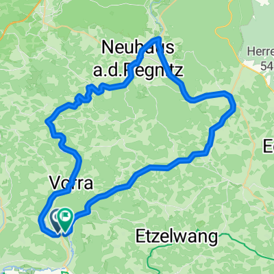
Artelshofen - Wander 1
A cycling route starting in Vorra, Bavaria, Germany.
Overview
About this route
- -:--
- Duration
- 5.7 km
- Distance
- 143 m
- Ascent
- 143 m
- Descent
- ---
- Avg. speed
- ---
- Max. altitude

Route quality
Waytypes & surfaces along the route
Waytypes
Track
3.9 km
(68 %)
Path
1.4 km
(25 %)
Surfaces
Paved
0.3 km
(5 %)
Unpaved
5.3 km
(92 %)
Gravel
4 km
(70 %)
Ground
1.3 km
(22 %)
Route highlights
Points of interest along the route
Point of interest after 0 km
E-Ladesäule Parkfrei
Continue with Bikemap
Use, edit, or download this cycling route
You would like to ride Artelshofen - Wander 1 or customize it for your own trip? Here is what you can do with this Bikemap route:
Free features
- Save this route as favorite or in collections
- Copy & plan your own version of this route
- Sync your route with Garmin or Wahoo
Premium features
Free trial for 3 days, or one-time payment. More about Bikemap Premium.
- Navigate this route on iOS & Android
- Export a GPX / KML file of this route
- Create your custom printout (try it for free)
- Download this route for offline navigation
Discover more Premium features.
Get Bikemap PremiumFrom our community
Other popular routes starting in Vorra
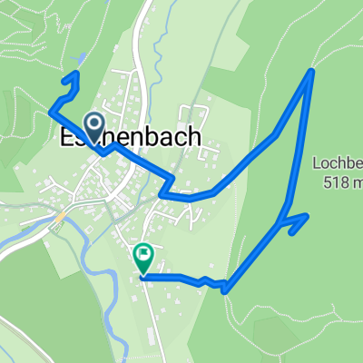
 D_Bayern_Eschenbach-Vorra-Velden-Neuhaus a.d. Pegnitz-Krottensee-Königsstein: durchs Hirschbachtal
- Distance
- 45.3 km
- Ascent
- 747 m
- Descent
- 751 m
- Location
- Vorra, Bavaria, Germany
 Eschenbak - Flachslanden
- Distance
- 81.8 km
- Ascent
- 306 m
- Descent
- 186 m
- Location
- Vorra, Bavaria, Germany
 2012 Pegnitzradweg-RotMain Radweg-Bayreuth
- Distance
- 78.4 km
- Ascent
- 438 m
- Descent
- 494 m
- Location
- Vorra, Bavaria, Germany
 Bahnhofstraße 12, Vorra nach Bahnhofstraße 4a, Vorra
- Distance
- 14 km
- Ascent
- 55 m
- Descent
- 53 m
- Location
- Vorra, Bavaria, Germany
 Vorra nach Lauf
- Distance
- 25.5 km
- Ascent
- 72 m
- Descent
- 102 m
- Location
- Vorra, Bavaria, Germany
 W - Eschenbach -Heroldturm - Luitpoldhöhle
- Distance
- 3.3 km
- Ascent
- 241 m
- Descent
- 241 m
- Location
- Vorra, Bavaria, Germany
 Vorra_Pielenhofen
- Distance
- 85.1 km
- Ascent
- 393 m
- Descent
- 418 m
- Location
- Vorra, Bavaria, Germany
 Jura Gebirgsweg - Gelbkreuz
- Distance
- 42.8 km
- Ascent
- 1,100 m
- Descent
- 958 m
- Location
- Vorra, Bavaria, Germany
Open it in the app