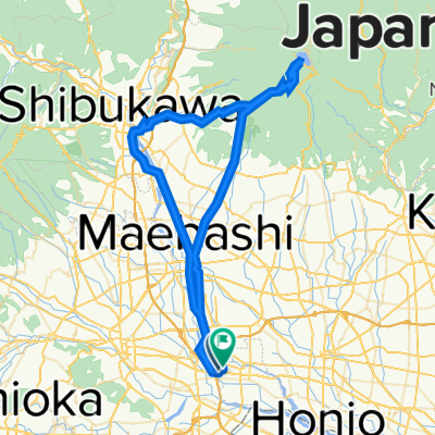
上里歴史巡りルート (上里町ルート)
A cycling route starting in Tamamura, Gunma, Japan.
Overview
About this route
- -:--
- Duration
- 14.3 km
- Distance
- 32 m
- Ascent
- 30 m
- Descent
- ---
- Avg. speed
- ---
- Avg. speed
Route quality
Waytypes & surfaces along the route
Waytypes
Quiet road
7.4 km
(52 %)
Road
4.6 km
(32 %)
Surfaces
Paved
2.1 km
(15 %)
Asphalt
1.6 km
(11 %)
Paved (undefined)
0.5 km
(4 %)
Undefined
12.2 km
(85 %)
Continue with Bikemap
Use, edit, or download this cycling route
You would like to ride 上里歴史巡りルート (上里町ルート) or customize it for your own trip? Here is what you can do with this Bikemap route:
Free features
- Save this route as favorite or in collections
- Copy & plan your own version of this route
- Sync your route with Garmin or Wahoo
Premium features
Free trial for 3 days, or one-time payment. More about Bikemap Premium.
- Navigate this route on iOS & Android
- Export a GPX / KML file of this route
- Create your custom printout (try it for free)
- Download this route for offline navigation
Discover more Premium features.
Get Bikemap PremiumFrom our community
Other popular routes starting in Tamamura
- 県道142号, Tamamura, Sawa-Gun to 650-1, Obata, Kanra, Kanra-Gun
- Distance
- 26.8 km
- Ascent
- 163 m
- Descent
- 39 m
- Location
- Tamamura, Gunma, Japan
- 900-2, Kamitakimachi, Takasaki-Shi to 900-2, Kamitakimachi, Takasaki-Shi
- Distance
- 64.7 km
- Ascent
- 201 m
- Descent
- 205 m
- Location
- Tamamura, Gunma, Japan
- 上里歴史巡りルート (上里町ルート)
- Distance
- 14.3 km
- Ascent
- 32 m
- Descent
- 30 m
- Location
- Tamamura, Gunma, Japan
- 350, Kamiiijima, Tamamura, Sawa-Gun to 351-2, Kamiiijima, Tamamura, Sawa-Gun
- Distance
- 38.7 km
- Ascent
- 355 m
- Descent
- 358 m
- Location
- Tamamura, Gunma, Japan
- Recovered Route
- Distance
- 2.3 km
- Ascent
- 23 m
- Descent
- 24 m
- Location
- Tamamura, Gunma, Japan
- 広瀬川サイクリングロード
- Distance
- 6.1 km
- Ascent
- 18 m
- Descent
- 26 m
- Location
- Tamamura, Gunma, Japan
- 55, Shimotakimachi, Takasaki to 55, Shimotakimachi, Takasaki
- Distance
- 28.1 km
- Ascent
- 134 m
- Descent
- 131 m
- Location
- Tamamura, Gunma, Japan
- 1189-4, Shimoshinden, Tamamura, Sawa-Gun to 国道18号, Annaka
- Distance
- 45.5 km
- Ascent
- 675 m
- Descent
- 146 m
- Location
- Tamamura, Gunma, Japan
Open it in the app