

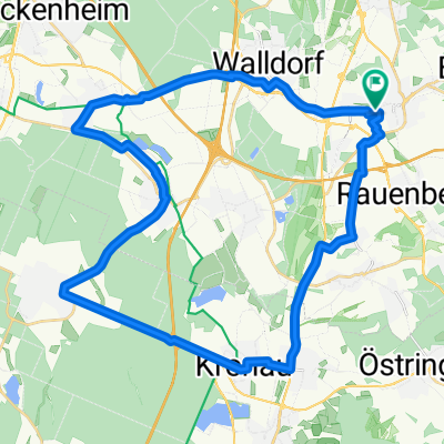
Wiesloch - Königstuhl
A cycling route starting in Wiesloch, Baden-Wurttemberg, Germany.
Overview
About this route
- -:--
- Duration
- 15.6 km
- Distance
- 519 m
- Ascent
- 85 m
- Descent
- ---
- Avg. speed
- ---
- Max. altitude

Continue with Bikemap
Use, edit, or download this cycling route
You would like to ride Wiesloch - Königstuhl or customize it for your own trip? Here is what you can do with this Bikemap route:
Free features
- Save this route as favorite or in collections
- Copy & plan your own version of this route
- Sync your route with Garmin or Wahoo
Premium features
Free trial for 3 days, or one-time payment. More about Bikemap Premium.
- Navigate this route on iOS & Android
- Export a GPX / KML file of this route
- Create your custom printout (try it for free)
- Download this route for offline navigation
Discover more Premium features.
Get Bikemap PremiumFrom our community
Other popular routes starting in Wiesloch
 Weinbergrundtour Wiesloch
- Distance
- 8.3 km
- Ascent
- 104 m
- Descent
- 100 m
- Location
- Wiesloch, Baden-Wurttemberg, Germany
 Wloch-Sternwarte Crossings+Loops 49-890hm
- Distance
- 48.7 km
- Ascent
- 854 m
- Descent
- 851 m
- Location
- Wiesloch, Baden-Wurttemberg, Germany
 Wiesloch-Hoffenheim-Eschelbach
- Distance
- 31.8 km
- Ascent
- 363 m
- Descent
- 356 m
- Location
- Wiesloch, Baden-Wurttemberg, Germany
 Wiesloch - SAP ROT
- Distance
- 9.9 km
- Ascent
- 33 m
- Descent
- 52 m
- Location
- Wiesloch, Baden-Wurttemberg, Germany
 move-Tour 1: Zum Golfplatz St. Leon-Rot
- Distance
- 21.1 km
- Ascent
- 47 m
- Descent
- 60 m
- Location
- Wiesloch, Baden-Wurttemberg, Germany
 Wiesloch - Königstuhl
- Distance
- 15.6 km
- Ascent
- 519 m
- Descent
- 85 m
- Location
- Wiesloch, Baden-Wurttemberg, Germany
 Feierabendrunde
- Distance
- 11.4 km
- Ascent
- 56 m
- Descent
- 59 m
- Location
- Wiesloch, Baden-Wurttemberg, Germany
 Reilingen - Kirrlach -Bad Schönborn
- Distance
- 37.7 km
- Ascent
- 76 m
- Descent
- 70 m
- Location
- Wiesloch, Baden-Wurttemberg, Germany
Open it in the app