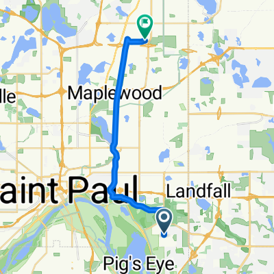
B2B00497 55106>55082 via Bruce Vento Trl, Gateway Trl, Myrtle Av
- 28.4 km
- 92 m
- 89 m
- Maplewood, Minnesota, United States
A cycling route starting in Maplewood, Minnesota, United States.
Overview
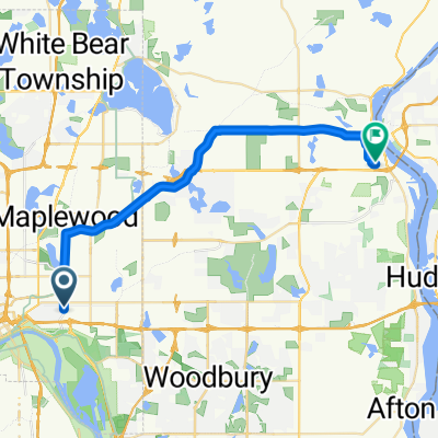
Take Upper Afton to Century Av and turn left. GO north on Century across I94 and turn right at Hudson Road. Follow Hudson Road around to Hadley. Take Hadley north until you cross Highway 36. Turn left on to Hwy. 36 Blvd and follow around to your destination.
Route quality
Road
7.2 km
(52 %)
Cycleway
5.1 km
(37 %)
Paved
13.2 km
(95 %)
Asphalt
10.1 km
(73 %)
Concrete
1.7 km
(12 %)
Continue with Bikemap
You would like to ride B2B00758 55119>55128 viaUpperAfton/Century/HudsonRd./Hadley Hudson or customize it for your own trip? Here is what you can do with this Bikemap route:
Free trial for 3 days, or one-time payment. More about Bikemap Premium.
Discover more Premium features.
Get Bikemap PremiumFrom our community
Open it in the app