

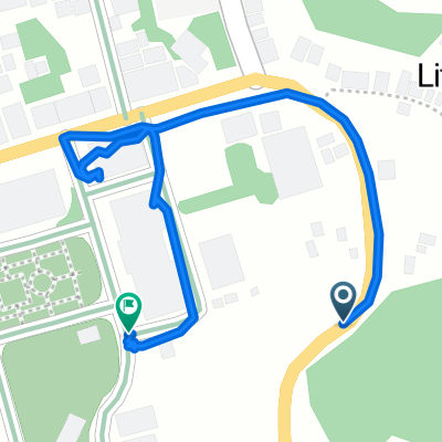
Mabini Avenue, Catbalogan City to Daang Maharlika Highway, Tarangnan
A cycling route starting in Catbalogan, Region VIII, Philippines.
Overview
About this route
- 1 h 37 min
- Duration
- 22.3 km
- Distance
- 47 m
- Ascent
- 48 m
- Descent
- 13.8 km/h
- Avg. speed
- ---
- Max. altitude

Route photos


Route quality
Waytypes & surfaces along the route
Waytypes
Cycleway
19.9 km
(89 %)
Access road
0.2 km
(1 %)
Undefined
2.2 km
(10 %)
Surfaces
Paved
21.2 km
(95 %)
Asphalt
21 km
(94 %)
Concrete
0.2 km
(1 %)
Undefined
1.1 km
(5 %)
Continue with Bikemap
Use, edit, or download this cycling route
You would like to ride Mabini Avenue, Catbalogan City to Daang Maharlika Highway, Tarangnan or customize it for your own trip? Here is what you can do with this Bikemap route:
Free features
- Save this route as favorite or in collections
- Copy & plan your own version of this route
- Sync your route with Garmin or Wahoo
Premium features
Free trial for 3 days, or one-time payment. More about Bikemap Premium.
- Navigate this route on iOS & Android
- Export a GPX / KML file of this route
- Create your custom printout (try it for free)
- Download this route for offline navigation
Discover more Premium features.
Get Bikemap PremiumFrom our community
Other popular routes starting in Catbalogan
 Guinsorongan-Bunuanan Road, Catbalogan City to Guinsorongan-Bunuanan Road, Catbalogan City
- Distance
- 5.7 km
- Ascent
- 115 m
- Descent
- 65 m
- Location
- Catbalogan, Region VIII, Philippines
 Jiabong
- Distance
- 10.2 km
- Ascent
- 156 m
- Descent
- 166 m
- Location
- Catbalogan, Region VIII, Philippines
 Route to Daang Maharlika Highway, Tarangnan
- Distance
- 20.7 km
- Ascent
- 0 m
- Descent
- 6 m
- Location
- Catbalogan, Region VIII, Philippines
 Mabini Avenue, Catbalogan City to Daang Maharlika Highway, Tarangnan
- Distance
- 22.3 km
- Ascent
- 47 m
- Descent
- 48 m
- Location
- Catbalogan, Region VIII, Philippines
 Daang Maharlika Highway, Catbalogan City to Daang Maharlika Highway, Paranas
- Distance
- 24.6 km
- Ascent
- 233 m
- Descent
- 245 m
- Location
- Catbalogan, Region VIII, Philippines
 Route from Daang Maharlika Highway, Catbalogan City
- Distance
- 0.6 km
- Ascent
- 0 m
- Descent
- 26 m
- Location
- Catbalogan, Region VIII, Philippines
 Catbalogan-Lagundi-Cawayan-StoNino
- Distance
- 10.2 km
- Ascent
- 366 m
- Descent
- 370 m
- Location
- Catbalogan, Region VIII, Philippines
 Philippines day13
- Distance
- 107.9 km
- Ascent
- 488 m
- Descent
- 489 m
- Location
- Catbalogan, Region VIII, Philippines
Open it in the app