Seniorenfräd 2011 HC 02
- 81.7 km
- 1,111 m
- 1,111 m
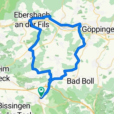
- Weilheim an der Teck, Baden-Wurttemberg, Germany
A cycling route starting in Weilheim an der Teck, Baden-Wurttemberg, Germany.
Overview
Gradient quotient = 15.5 m/km
Reference: Alb Extrem 190 km = 15.8 m/km
created this 14 years ago
Route quality
Quiet road
18.8 km
(23 %)
Track
17.2 km
(21 %)
Paved
58 km
(71 %)
Unpaved
1.6 km
(2 %)
Asphalt
53.9 km
(66 %)
Paved (undefined)
4.1 km
(5 %)
Route highlights
Continue with Bikemap
You would like to ride Seniorenfräd 2011 HC 02 or customize it for your own trip? Here is what you can do with this Bikemap route:
Free trial for 3 days, or one-time payment. More about Bikemap Premium.
Discover more Premium features.
Get Bikemap PremiumFrom our community
Open it in the app