

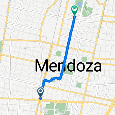
zoo - papagallos - dibu corto - bajada del acantilado
A cycling route starting in Mendoza, Mendoza Province, Argentina.
Overview
About this route
muy buena alternativa al sendero convencional de subida y bajada a papagallos desde el zoo
con mucha adrenalina en la bajada
- -:--
- Duration
- 16.2 km
- Distance
- 305 m
- Ascent
- 302 m
- Descent
- ---
- Avg. speed
- ---
- Max. altitude

Route highlights
Points of interest along the route
Point of interest after 3.6 km
empalme con la ruta de subida
Point of interest after 7.5 km
desvio para el dibu-corto y retornar para seguir subiendo
Point of interest after 7.6 km
Point of interest after 8.5 km
paredon 45°
Point of interest after 9.2 km
1er desvio camino alternativo ultra copado, "el sendero de los cactus"
Point of interest after 9.8 km
empalme con el sendero de bajada original "scoobies tierra colorada"
Point of interest after 10.5 km
desvio al sendero panoramico con mucha adrenalina aka "bajada del acantilado yahooooo!!!"
Continue with Bikemap
Use, edit, or download this cycling route
You would like to ride zoo - papagallos - dibu corto - bajada del acantilado or customize it for your own trip? Here is what you can do with this Bikemap route:
Free features
- Save this route as favorite or in collections
- Copy & plan your own version of this route
- Sync your route with Garmin or Wahoo
Premium features
Free trial for 3 days, or one-time payment. More about Bikemap Premium.
- Navigate this route on iOS & Android
- Export a GPX / KML file of this route
- Create your custom printout (try it for free)
- Download this route for offline navigation
Discover more Premium features.
Get Bikemap PremiumFrom our community
Other popular routes starting in Mendoza
 MENDOZA CAPITAL - VIÑA DEL MAR
- Distance
- 402.9 km
- Ascent
- 2,716 m
- Descent
- 3,457 m
- Location
- Mendoza, Mendoza Province, Argentina
 Cacheuta
- Distance
- 79.1 km
- Ascent
- 578 m
- Descent
- 544 m
- Location
- Mendoza, Mendoza Province, Argentina
 Mendoza - Pocito
- Distance
- 159.1 km
- Ascent
- 79 m
- Descent
- 234 m
- Location
- Mendoza, Mendoza Province, Argentina
 Cruce de los Andes por Cristo Redentor
- Distance
- 363 km
- Ascent
- 3,586 m
- Descent
- 3,782 m
- Location
- Mendoza, Mendoza Province, Argentina
 zoo - papagallos - dibu corto - bajada del acantilado
- Distance
- 16.2 km
- Ascent
- 305 m
- Descent
- 302 m
- Location
- Mendoza, Mendoza Province, Argentina
 Travesia en bici por mendoza
- Distance
- 385.9 km
- Ascent
- 3,716 m
- Descent
- 3,525 m
- Location
- Mendoza, Mendoza Province, Argentina
 istecc - csas
- Distance
- 2.3 km
- Ascent
- 0 m
- Descent
- 23 m
- Location
- Mendoza, Mendoza Province, Argentina
 Entreno C°Gloria y Llorón
- Distance
- 5.5 km
- Ascent
- 146 m
- Descent
- 148 m
- Location
- Mendoza, Mendoza Province, Argentina
Open it in the app