

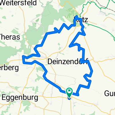
Zellerndorf - Melk 2021
A cycling route starting in Zellerndorf, Lower Austria, Austria.
Overview
About this route
- -:--
- Duration
- 104.7 km
- Distance
- 688 m
- Ascent
- 681 m
- Descent
- ---
- Avg. speed
- ---
- Max. altitude

Route quality
Waytypes & surfaces along the route
Waytypes
Track
38.7 km
(37 %)
Road
22 km
(21 %)
Surfaces
Paved
79.6 km
(76 %)
Unpaved
10.5 km
(10 %)
Asphalt
73.3 km
(70 %)
Paved (undefined)
6.3 km
(6 %)
Continue with Bikemap
Use, edit, or download this cycling route
You would like to ride Zellerndorf - Melk 2021 or customize it for your own trip? Here is what you can do with this Bikemap route:
Free features
- Save this route as favorite or in collections
- Copy & plan your own version of this route
- Split it into stages to create a multi-day tour
- Sync your route with Garmin or Wahoo
Premium features
Free trial for 3 days, or one-time payment. More about Bikemap Premium.
- Navigate this route on iOS & Android
- Export a GPX / KML file of this route
- Create your custom printout (try it for free)
- Download this route for offline navigation
Discover more Premium features.
Get Bikemap PremiumFrom our community
Other popular routes starting in Zellerndorf
 Zellerndorf - Melk 2021
- Distance
- 104.7 km
- Ascent
- 688 m
- Descent
- 681 m
- Location
- Zellerndorf, Lower Austria, Austria
 Riesling
- Distance
- 52.3 km
- Ascent
- 379 m
- Descent
- 383 m
- Location
- Zellerndorf, Lower Austria, Austria
 burgunder-chardonnayweg
- Distance
- 66.7 km
- Ascent
- 819 m
- Descent
- 816 m
- Location
- Zellerndorf, Lower Austria, Austria
 Zellerndorf - Raabs an der Thaya
- Distance
- 55.3 km
- Ascent
- 589 m
- Descent
- 399 m
- Location
- Zellerndorf, Lower Austria, Austria
 Platt 31 nach Pulkauer Straße 640/2, Röschitz
- Distance
- 9.9 km
- Ascent
- 100 m
- Descent
- 62 m
- Location
- Zellerndorf, Lower Austria, Austria
 Zellerndorf - Krems 2021
- Distance
- 67.4 km
- Ascent
- 626 m
- Descent
- 649 m
- Location
- Zellerndorf, Lower Austria, Austria
 burgunder-chardonnayweg
- Distance
- 66.7 km
- Ascent
- 536 m
- Descent
- 535 m
- Location
- Zellerndorf, Lower Austria, Austria
 Roseldorf 63 nach Roseldorf 63
- Distance
- 62.6 km
- Ascent
- 993 m
- Descent
- 984 m
- Location
- Zellerndorf, Lower Austria, Austria
Open it in the app