

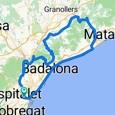
Barcelona(Estació de Sants)-Cerdanyola del Vallès
A cycling route starting in Sants-Montjuïc, Catalonia, Spain.
Overview
About this route
A route designed for mountain biking, which includes stretches of paved road and stretches of dirt tracks.
It lasts two hours.
You can enjoy fantastic views of Barcelona from the Collserola mountain and descents where the cyclist can enjoy the breeze while descending through the shaded area of the Collserola mountain.
The unpaved road sections make it necessary to use a mountain bike with suspension, as high speeds can be reached and the paths have holes and sharp curves.
- -:--
- Duration
- 21.4 km
- Distance
- 503 m
- Ascent
- 462 m
- Descent
- ---
- Avg. speed
- ---
- Max. altitude

Route quality
Waytypes & surfaces along the route
Waytypes
Road
8.8 km
(41 %)
Quiet road
4.1 km
(19 %)
Surfaces
Paved
14.4 km
(67 %)
Unpaved
3.2 km
(15 %)
Asphalt
14.1 km
(66 %)
Gravel
1.5 km
(7 %)
Continue with Bikemap
Use, edit, or download this cycling route
You would like to ride Barcelona(Estació de Sants)-Cerdanyola del Vallès or customize it for your own trip? Here is what you can do with this Bikemap route:
Free features
- Save this route as favorite or in collections
- Copy & plan your own version of this route
- Sync your route with Garmin or Wahoo
Premium features
Free trial for 3 days, or one-time payment. More about Bikemap Premium.
- Navigate this route on iOS & Android
- Export a GPX / KML file of this route
- Create your custom printout (try it for free)
- Download this route for offline navigation
Discover more Premium features.
Get Bikemap PremiumFrom our community
Other popular routes starting in Sants-Montjuïc
 SANT MIQUEL DEL FAI
- Distance
- 118.4 km
- Ascent
- 0 m
- Descent
- 0 m
- Location
- Sants-Montjuïc, Catalonia, Spain
 BCN, Sant Cugat, Montcada, Sant Adrià, BCN
- Distance
- 49.9 km
- Ascent
- 1,143 m
- Descent
- 1,161 m
- Location
- Sants-Montjuïc, Catalonia, Spain
 Carretera de les Aigues
- Distance
- 24.5 km
- Ascent
- 576 m
- Descent
- 577 m
- Location
- Sants-Montjuïc, Catalonia, Spain
 De Avinguda de la Granvia de l’Hospitalet 23, L'Hospitalet de Llobregat a Avinguda de la Granvia de l’Hospitalet 19, L'Hospitalet de Llobregat
- Distance
- 20.7 km
- Ascent
- 347 m
- Descent
- 344 m
- Location
- Sants-Montjuïc, Catalonia, Spain
 Barcelona(Estació de Sants)-Cerdanyola del Vallès
- Distance
- 21.4 km
- Ascent
- 503 m
- Descent
- 462 m
- Location
- Sants-Montjuïc, Catalonia, Spain
 Dominique Rollin route III
- Distance
- 98.2 km
- Ascent
- 857 m
- Descent
- 857 m
- Location
- Sants-Montjuïc, Catalonia, Spain
 una gita al mare
- Distance
- 64.9 km
- Ascent
- 962 m
- Descent
- 984 m
- Location
- Sants-Montjuïc, Catalonia, Spain
 City Bike Route
- Distance
- 17.9 km
- Ascent
- 99 m
- Descent
- 97 m
- Location
- Sants-Montjuïc, Catalonia, Spain
Open it in the app