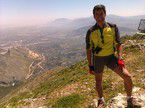
Jaen-La Cuesta Negra-Fuente el Palo-Ermita San Isidro-Jamilena-Torredonjimeno-Jaen
A cycling route starting in Jaén, Andalusia, Spain.
Overview
About this route
Hybrid route, asphalt for the climb up to Neveral, gravel through Cuesta la Negra and then forest tracks with a route up to the climb towards Jabalcuz which we leave to the left to descend in the opposite direction down to Fuente del Palo and then climb again to the turnoff towards the Ermita de San Isidro, spectacular views. We descend down to Jamilena and take the Via Verde back from Torredonjimeno.
- -:--
- Duration
- 43.8 km
- Distance
- 825 m
- Ascent
- 825 m
- Descent
- ---
- Avg. speed
- ---
- Max. altitude
Continue with Bikemap
Use, edit, or download this cycling route
You would like to ride Jaen-La Cuesta Negra-Fuente el Palo-Ermita San Isidro-Jamilena-Torredonjimeno-Jaen or customize it for your own trip? Here is what you can do with this Bikemap route:
Free features
- Save this route as favorite or in collections
- Copy & plan your own version of this route
- Sync your route with Garmin or Wahoo
Premium features
Free trial for 3 days, or one-time payment. More about Bikemap Premium.
- Navigate this route on iOS & Android
- Export a GPX / KML file of this route
- Create your custom printout (try it for free)
- Download this route for offline navigation
Discover more Premium features.
Get Bikemap PremiumFrom our community
Other popular routes starting in Jaén
 CARRIL BICI DE JABALCÚZ
- Distance
- 53.8 km
- Ascent
- 639 m
- Descent
- 632 m
- Location
- Jaén, Andalusia, Spain
 JAEN-GRANADA CICLOTURISMO
- Distance
- 97.7 km
- Ascent
- 1,010 m
- Descent
- 757 m
- Location
- Jaén, Andalusia, Spain
 JAEN-SIERRA SUR
- Distance
- 69.9 km
- Ascent
- 1,432 m
- Descent
- 1,009 m
- Location
- Jaén, Andalusia, Spain
 El reto de la policía
- Distance
- 55.7 km
- Ascent
- 1,233 m
- Descent
- 1,265 m
- Location
- Jaén, Andalusia, Spain
 Up-Puente Tablas-Grañena-El Termino-Cortijo Azovar-Via Verde-Up
- Distance
- 39.9 km
- Ascent
- 337 m
- Descent
- 337 m
- Location
- Jaén, Andalusia, Spain
 Jaen-La Cuesta Negra-Fuente el Palo-Ermita San Isidro-Jamilena-Torredonjimeno-Jaen
- Distance
- 43.8 km
- Ascent
- 825 m
- Descent
- 825 m
- Location
- Jaén, Andalusia, Spain
 Peñas de Castro
- Distance
- 19.4 km
- Ascent
- 548 m
- Descent
- 551 m
- Location
- Jaén, Andalusia, Spain
 Jaén Puerto Alto La Guardia Puente Jontoya Jaén
- Distance
- 30.6 km
- Ascent
- 493 m
- Descent
- 493 m
- Location
- Jaén, Andalusia, Spain
Open it in the app


