

Woodlands Avenue 24, Hartbeespoort to Woodlands Avenue 33, Hartbeespoort
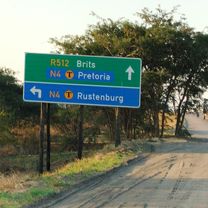
A cycling route starting in Brits, North West, Republic of South Africa.
Overview
About this route
- 3 h 8 min
- Duration
- 47.7 km
- Distance
- 561 m
- Ascent
- 559 m
- Descent
- 15.3 km/h
- Avg. speed
- ---
- Max. altitude

Continue with Bikemap
Use, edit, or download this cycling route
You would like to ride Woodlands Avenue 24, Hartbeespoort to Woodlands Avenue 33, Hartbeespoort or customize it for your own trip? Here is what you can do with this Bikemap route:
Free features
- Save this route as favorite or in collections
- Copy & plan your own version of this route
- Sync your route with Garmin or Wahoo
Premium features
Free trial for 3 days, or one-time payment. More about Bikemap Premium.
- Navigate this route on iOS & Android
- Export a GPX / KML file of this route
- Create your custom printout (try it for free)
- Download this route for offline navigation
Discover more Premium features.
Get Bikemap PremiumFrom our community
Other popular routes starting in Brits
 Route from Magalies Blvd, Hartbeespoort
- Distance
- 6.2 km
- Ascent
- 16 m
- Descent
- 4 m
- Location
- Brits, North West, Republic of South Africa
 Club Crescent, Hartbeespoort to R560, Hartbeespoort
- Distance
- 10 km
- Ascent
- 95 m
- Descent
- 56 m
- Location
- Brits, North West, Republic of South Africa
 Van Gaalen_MTB_Flowtrail South Africa
- Distance
- 20 km
- Ascent
- 174 m
- Descent
- 166 m
- Location
- Brits, North West, Republic of South Africa
 Rust Oord 83Km
- Distance
- 82.9 km
- Ascent
- 390 m
- Descent
- 390 m
- Location
- Brits, North West, Republic of South Africa
 Race to the sun
- Distance
- 167.3 km
- Ascent
- 390 m
- Descent
- 411 m
- Location
- Brits, North West, Republic of South Africa
 Woodlands Avenue 24, Hartbeespoort to Woodlands Avenue 33, Hartbeespoort
- Distance
- 47.7 km
- Ascent
- 561 m
- Descent
- 559 m
- Location
- Brits, North West, Republic of South Africa
 Hartebeespoorht to Damonsville
- Distance
- 19.3 km
- Ascent
- 138 m
- Descent
- 174 m
- Location
- Brits, North West, Republic of South Africa
 Route from Krokkodildrif Lane
- Distance
- 40.2 km
- Ascent
- 231 m
- Descent
- 247 m
- Location
- Brits, North West, Republic of South Africa
Open it in the app