

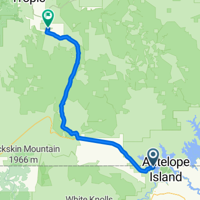
Dag 024 Waheap Bay - Kodachrome State Park
A cycling route starting in Page, Arizona, United States.
Overview
About this route
- -:--
- Duration
- 101.7 km
- Distance
- 1,052 m
- Ascent
- 428 m
- Descent
- ---
- Avg. speed
- ---
- Max. altitude
Route quality
Waytypes & surfaces along the route
Waytypes
Quiet road
60.3 km
(59 %)
Cycleway
19.3 km
(19 %)
Surfaces
Paved
24.2 km
(24 %)
Unpaved
71.6 km
(70 %)
Ground
29.5 km
(29 %)
Unpaved (undefined)
28.5 km
(28 %)
Route highlights
Points of interest along the route
Point of interest after 39 km
Ranger station voor 9.00 permits vragen. loterij 10 per dag.
Accommodation after 48 km
paria campground bij Paria Adventure Ranch.
Point of interest after 75 km
Cottonwood creek, at about the halfway point of Cottonwood Canyon road. So I set up camp in the shade of juniper and cottonwood trees at 5100 feet elevation. 75 km na Waheap campground. Grosvenor Arch hier in de buurt
Continue with Bikemap
Use, edit, or download this cycling route
You would like to ride Dag 024 Waheap Bay - Kodachrome State Park or customize it for your own trip? Here is what you can do with this Bikemap route:
Free features
- Save this route as favorite or in collections
- Copy & plan your own version of this route
- Split it into stages to create a multi-day tour
- Sync your route with Garmin or Wahoo
Premium features
Free trial for 3 days, or one-time payment. More about Bikemap Premium.
- Navigate this route on iOS & Android
- Export a GPX / KML file of this route
- Create your custom printout (try it for free)
- Download this route for offline navigation
Discover more Premium features.
Get Bikemap PremiumFrom our community
Other popular routes starting in Page
 Dag 024 Waheap Bay - Kodachrome State Park
- Distance
- 101.7 km
- Ascent
- 1,052 m
- Descent
- 428 m
- Location
- Page, Arizona, United States
 DISSCH Page - Grand Canyon
- Distance
- 222.1 km
- Ascent
- 1,700 m
- Descent
- 933 m
- Location
- Page, Arizona, United States
 USA 96/16
- Distance
- 110.6 km
- Ascent
- 1,114 m
- Descent
- 451 m
- Location
- Page, Arizona, United States
 Page
Page- Distance
- 30.8 km
- Ascent
- 368 m
- Descent
- 367 m
- Location
- Page, Arizona, United States
 Road to Studhorse Point
- Distance
- 6.9 km
- Ascent
- 0 m
- Descent
- 0 m
- Location
- Page, Arizona, United States
 Etappe 4: Page - Las Vegas
- Distance
- 451.1 km
- Ascent
- 1,715 m
- Descent
- 2,398 m
- Location
- Page, Arizona, United States
 11.Tag
- Distance
- 132.7 km
- Ascent
- 869 m
- Descent
- 885 m
- Location
- Page, Arizona, United States
 South 7th Avenue 75, Page nach Apache Street 13, Grand Canyon Village
- Distance
- 205.7 km
- Ascent
- 2,111 m
- Descent
- 1,325 m
- Location
- Page, Arizona, United States
Open it in the app