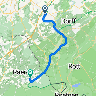
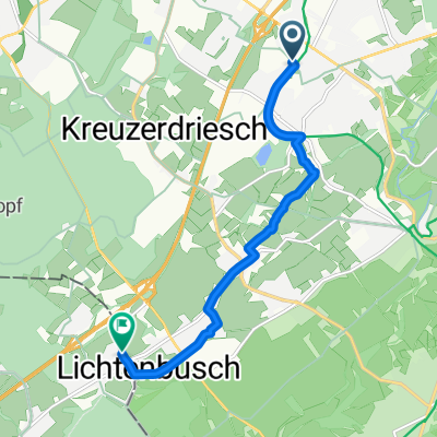
Mausbach - Eilendorf
A cycling route starting in Stolberg, North Rhine-Westphalia, Germany.
Overview
About this route
Mausbach Rothe Gasse - Industriegebiet Eilendorf (Vennbahnweg gesperrt)
- -:--
- Duration
- 17.2 km
- Distance
- 147 m
- Ascent
- 179 m
- Descent
- ---
- Avg. speed
- 274 m
- Max. altitude
Route quality
Waytypes & surfaces along the route
Waytypes
Quiet road
4.5 km
(26 %)
Path
4.3 km
(25 %)
Surfaces
Paved
14.9 km
(86 %)
Unpaved
0.1 km
(<1 %)
Asphalt
13.9 km
(80 %)
Paved (undefined)
0.6 km
(3 %)
Continue with Bikemap
Use, edit, or download this cycling route
You would like to ride Mausbach - Eilendorf or customize it for your own trip? Here is what you can do with this Bikemap route:
Free features
- Save this route as favorite or in collections
- Copy & plan your own version of this route
- Sync your route with Garmin or Wahoo
Premium features
Free trial for 3 days, or one-time payment. More about Bikemap Premium.
- Navigate this route on iOS & Android
- Export a GPX / KML file of this route
- Create your custom printout (try it for free)
- Download this route for offline navigation
Discover more Premium features.
Get Bikemap PremiumFrom our community
Other popular routes starting in Stolberg
- AC-Jülich-EIfel-AC
- Distance
- 68.2 km
- Ascent
- 398 m
- Descent
- 398 m
- Location
- Stolberg, North Rhine-Westphalia, Germany
- Kleine Drei-Länder-Tour
- Distance
- 65.8 km
- Ascent
- 420 m
- Descent
- 472 m
- Location
- Stolberg, North Rhine-Westphalia, Germany
- Route in Stolberg (Rheinland)
- Distance
- 158.3 km
- Ascent
- 3,196 m
- Descent
- 3,190 m
- Location
- Stolberg, North Rhine-Westphalia, Germany
- Teil des Hasselbach Trails
- Distance
- 34.6 km
- Ascent
- 454 m
- Descent
- 418 m
- Location
- Stolberg, North Rhine-Westphalia, Germany
- Vlissingen
- Distance
- 250.6 km
- Ascent
- 111 m
- Descent
- 283 m
- Location
- Stolberg, North Rhine-Westphalia, Germany
- Indetal und Altstadt von Stolberg
- Distance
- 27.4 km
- Ascent
- 249 m
- Descent
- 248 m
- Location
- Stolberg, North Rhine-Westphalia, Germany
- Eifelsteig all stages
- Distance
- 313 km
- Ascent
- 1,671 m
- Descent
- 1,753 m
- Location
- Stolberg, North Rhine-Westphalia, Germany
- Donnerberg- Diepenlinchen- Stolberger Burg
- Distance
- 8.4 km
- Ascent
- 185 m
- Descent
- 188 m
- Location
- Stolberg, North Rhine-Westphalia, Germany
Open it in the app