Feierabendrunde
- 52.7 km
- 351 m
- 349 m
- Heidenau, Saxony, Germany
A cycling route starting in Heidenau, Saxony, Germany.
Overview
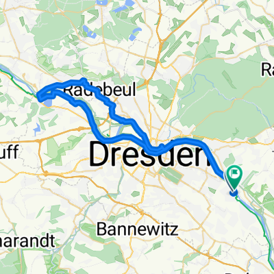
Start is in Laubegast, where we first head to the Elbe river and then towards Schillerplatz and Blaues Wunder. We cross this and proceed via the main route up to the Schönfelder Highlands. There, passing the television tower, we ride through beautiful little villages. In Rockau, there is a nice viewing point. Continuing on through Schönfeld (where there is a castle), Eschdorf, Wünschendorf, we return to the Elbe towards Pirna. In Pirna, we cross the bridge and then leisurely ride back along the Elbe cycle path towards Dresden. Past the car ferry to Pillnitz, we head back towards Laubegast. At Gerücht, we can make a stop and conclude the tour with a delicious Laubegaster red beer at Monty.
created this 18 years ago
Route quality
Quiet road
13.3 km
(30 %)
Cycleway
10.2 km
(23 %)
Paved
41.1 km
(93 %)
Unpaved
1.3 km
(3 %)
Asphalt
40.7 km
(92 %)
Ground
1.3 km
(3 %)
Continue with Bikemap
You would like to ride Schönfelder Hochlandtour or customize it for your own trip? Here is what you can do with this Bikemap route:
Free trial for 3 days, or one-time payment. More about Bikemap Premium.
Discover more Premium features.
Get Bikemap PremiumFrom our community
Open it in the app