Morgen-Route
- 23.3 km
- 114 m
- 117 m
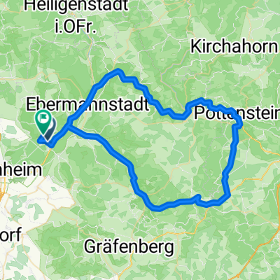
- Weilersbach, Bavaria, Germany
A cycling route starting in Weilersbach, Bavaria, Germany.
Overview
Nothing for family outings. Once you have conquered the first long climb just past Kauernhofen, turn right towards the chapel. Those who want to shorten can also go straight ahead (but it is a very natural path). At the Feuerstein airfield, enjoy the view of the valley for a moment and then after a short ascent, head back down into the valley. Then follow the B 470 along the bike path and after the 'Schweizer Keller' turn right, the next left and then sharply right again and then always straight up. At the top there is a brief downward slope and then to the right. You will then pass by a small pond and shortly thereafter reach the starting point again.
created this 17 years ago
Route quality
Track
12.2 km
(49 %)
Quiet road
4.7 km
(19 %)
Paved
13 km
(52 %)
Unpaved
11 km
(44 %)
Asphalt
13 km
(52 %)
Gravel
10.2 km
(41 %)
Continue with Bikemap
You would like to ride Feuerstein rauf und runter und wieder hoch or customize it for your own trip? Here is what you can do with this Bikemap route:
Free trial for 3 days, or one-time payment. More about Bikemap Premium.
Discover more Premium features.
Get Bikemap PremiumFrom our community
Open it in the app