

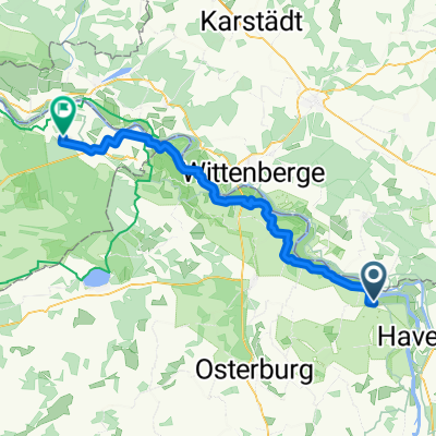
Tour Brandenburg 2
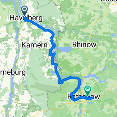
A cycling route starting in Havelberg, Saxony-Anhalt, Germany.
Overview
About this route
27.07.21 from Campinginsel Havelberg to Campingplatz Flecken Zechlin 105 km
- -:--
- Duration
- 103.4 km
- Distance
- 260 m
- Ascent
- 229 m
- Descent
- ---
- Avg. speed
- ---
- Max. altitude

Route quality
Waytypes & surfaces along the route
Waytypes
Path
32.1 km
(31 %)
Road
25.9 km
(25 %)
Surfaces
Paved
72.4 km
(70 %)
Unpaved
5.2 km
(5 %)
Asphalt
68.3 km
(66 %)
Unpaved (undefined)
4.1 km
(4 %)
Continue with Bikemap
Use, edit, or download this cycling route
You would like to ride Tour Brandenburg 2 or customize it for your own trip? Here is what you can do with this Bikemap route:
Free features
- Save this route as favorite or in collections
- Copy & plan your own version of this route
- Split it into stages to create a multi-day tour
- Sync your route with Garmin or Wahoo
Premium features
Free trial for 3 days, or one-time payment. More about Bikemap Premium.
- Navigate this route on iOS & Android
- Export a GPX / KML file of this route
- Create your custom printout (try it for free)
- Download this route for offline navigation
Discover more Premium features.
Get Bikemap PremiumFrom our community
Other popular routes starting in Havelberg
 Tour Brandenburg 2
- Distance
- 103.4 km
- Ascent
- 260 m
- Descent
- 229 m
- Location
- Havelberg, Saxony-Anhalt, Germany
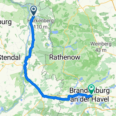 Von Havelberg bis Brandenburg(Havel)
- Distance
- 89.7 km
- Ascent
- 222 m
- Descent
- 214 m
- Location
- Havelberg, Saxony-Anhalt, Germany
 Havelberg - Berlin
- Distance
- 204.2 km
- Ascent
- 602 m
- Descent
- 593 m
- Location
- Havelberg, Saxony-Anhalt, Germany
 Mo_Etappe-3 Altmärkische Wische bis Gartow
- Distance
- 56.2 km
- Ascent
- 77 m
- Descent
- 84 m
- Location
- Havelberg, Saxony-Anhalt, Germany
 Havelberg Hohen Neuendorf
- Distance
- 82.3 km
- Ascent
- 111 m
- Descent
- 103 m
- Location
- Havelberg, Saxony-Anhalt, Germany
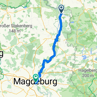 Havelberg - Magdeburg
- Distance
- 108.5 km
- Ascent
- 268 m
- Descent
- 252 m
- Location
- Havelberg, Saxony-Anhalt, Germany
 20160711_124347.gpx
- Distance
- 59.4 km
- Ascent
- 86 m
- Descent
- 88 m
- Location
- Havelberg, Saxony-Anhalt, Germany
 Bischofstour
- Distance
- 110.4 km
- Ascent
- 240 m
- Descent
- 218 m
- Location
- Havelberg, Saxony-Anhalt, Germany
Open it in the app