

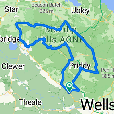
Lejog Day 5: Cotswolds Route
A cycling route starting in Wells, England, United Kingdom.
Overview
About this route
- -:--
- Duration
- 102.4 km
- Distance
- 573 m
- Ascent
- 583 m
- Descent
- ---
- Avg. speed
- ---
- Max. altitude

Route quality
Waytypes & surfaces along the route
Waytypes
Quiet road
49.2 km
(48 %)
Road
23.6 km
(23 %)
Surfaces
Paved
45.1 km
(44 %)
Unpaved
8.2 km
(8 %)
Asphalt
41 km
(40 %)
Gravel
8.2 km
(8 %)
Route highlights
Points of interest along the route
Drinking water after 25.2 km
Bruces Bikes 22 High Street, Paulton, Bristol, Avon BS39 7QF 01761 416001 brucesbikes.co.uk
Drinking water after 25.2 km
Bike It County Bridge, Radstock, Avon BA3 3AA 01761 431502
Drinking water after 47.3 km
TT Cycles @ The Lock Inn 48 FROME ROAD, BRADFORD-ON-AVON, WILTSHIRE, BA15 1LE
Point of interest after 87.5 km
Newark Park House and Tea
Accommodation after 92.7 km
The Swan Hotel 16 Market Street, Wotton-under-Edge, Gloucestershire GL12 7AE 01453 843004 swanhotelwotton.co.uk
Drinking water after 92.7 km
The Cycle Shop 7 Long St, Wotton-under-Edge GL12 7ES 01453 842259
Accommodation after 102.4 km
Road Green House North Nibley, Nr Dursley, Gloucestershire GL11 6BA 01453 544070 roadgreenhouse.com
Accommodation after 102.4 km
Malt House 22 Marybrook Street, Berkeley, Gloucestershire GL13 9BA 01453 511177 themalthouse.uk.com
Accommodation after 102.4 km
Pickwick Farmhouse B&B This is an unverified listing Berkeley Heath, Berkeley, Gloucestershire GL13 9EU 01453 810241
Accommodation after 102.4 km
Berkeley Arms Hotel Canonbury St, Berkeley GL13 9BG 01453 811177 theberkeleyarms.com
Accommodation after 102.4 km
The Tudor Arms Shepherds Patch, Slimbridge, GL2 7BP 01453 890306 thetudorarms.co.uk
Continue with Bikemap
Use, edit, or download this cycling route
You would like to ride Lejog Day 5: Cotswolds Route or customize it for your own trip? Here is what you can do with this Bikemap route:
Free features
- Save this route as favorite or in collections
- Copy & plan your own version of this route
- Split it into stages to create a multi-day tour
- Sync your route with Garmin or Wahoo
Premium features
Free trial for 3 days, or one-time payment. More about Bikemap Premium.
- Navigate this route on iOS & Android
- Export a GPX / KML file of this route
- Create your custom printout (try it for free)
- Download this route for offline navigation
Discover more Premium features.
Get Bikemap PremiumFrom our community
Other popular routes starting in Wells
 Wells Cathedral, Cathedral Green, Wells to Wells Cathedral, Cathedral Green, Wells
- Distance
- 27.5 km
- Ascent
- 140 m
- Descent
- 141 m
- Location
- Wells, England, United Kingdom
 Lejog Day 5: Cotswolds Route
- Distance
- 102.4 km
- Ascent
- 573 m
- Descent
- 583 m
- Location
- Wells, England, United Kingdom
 Bishops Park Way, Wells to 2 Meare Road, Glastonbury
- Distance
- 10.7 km
- Ascent
- 35 m
- Descent
- 73 m
- Location
- Wells, England, United Kingdom
 Wells and Blagdon
- Distance
- 56.7 km
- Ascent
- 632 m
- Descent
- 632 m
- Location
- Wells, England, United Kingdom
 Wells to Monmouth
- Distance
- 108.4 km
- Ascent
- 480 m
- Descent
- 496 m
- Location
- Wells, England, United Kingdom
 Bristolo-Wells-Stonehenge Eton-London
- Distance
- 312.1 km
- Ascent
- 1,074 m
- Descent
- 1,110 m
- Location
- Wells, England, United Kingdom
 Wells - Blagdon
- Distance
- 78.3 km
- Ascent
- 1,236 m
- Descent
- 1,056 m
- Location
- Wells, England, United Kingdom
 Easton and Cheddar
- Distance
- 42.4 km
- Ascent
- 597 m
- Descent
- 596 m
- Location
- Wells, England, United Kingdom
Open it in the app