

H46: Im Tal der Biela
A cycling route starting in Königstein, Saxony, Germany.
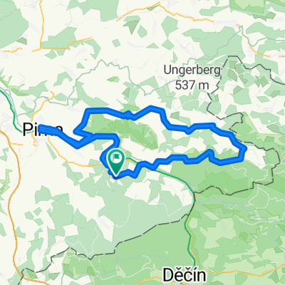
Overview
About this route
Diese Tour ist typisch für das südliche Ellbsandsteingebirge. Die Felsregionen sind auf die eingeschnittenen Täler beschränkt, ansonsten sind die gleichmäßig nach Süden ansteigenden Hochflächen stark bewaldet.
Besonders sehenswert wegen seiner schroffen Felsen ist das Tal der Dürren Biela. Mit etwas Glück kann man hier sogar Kletterer direkt vom Wegesrand beobachten. Als Einkehrmöglichkeit eignet sich der Imbiß Daxensteinbaude im Ortsteil Ottomühle.- -:--
- Duration
- 13 km
- Distance
- 203 m
- Ascent
- 198 m
- Descent
- ---
- Avg. speed
- ---
- Max. altitude

Route quality
Waytypes & surfaces along the route
Waytypes
Track
7 km
(53 %)
Road
3.6 km
(28 %)
Surfaces
Paved
6.4 km
(49 %)
Unpaved
6.4 km
(49 %)
Asphalt
6.4 km
(49 %)
Gravel
4.2 km
(32 %)
Route highlights
Points of interest along the route

Photo after 6.8 km

Photo after 7.1 km

Photo after 10.1 km
Accommodation after 10.1 km
Imbiß "Daxensteinbaude"

Photo after 10.8 km
Continue with Bikemap
Use, edit, or download this cycling route
You would like to ride H46: Im Tal der Biela or customize it for your own trip? Here is what you can do with this Bikemap route:
Free features
- Save this route as favorite or in collections
- Copy & plan your own version of this route
- Sync your route with Garmin or Wahoo
Premium features
Free trial for 3 days, or one-time payment. More about Bikemap Premium.
- Navigate this route on iOS & Android
- Export a GPX / KML file of this route
- Create your custom printout (try it for free)
- Download this route for offline navigation
Discover more Premium features.
Get Bikemap PremiumFrom our community
Other popular routes starting in Königstein
 Praga-Hamburg
- Distance
- 1,192.2 km
- Ascent
- 4,233 m
- Descent
- 4,174 m
- Location
- Königstein, Saxony, Germany
 ERW2: Königstein Bahnhof-Elbradweg-Meißen Bhf.
- Distance
- 65.7 km
- Ascent
- 1,226 m
- Descent
- 1,238 m
- Location
- Königstein, Saxony, Germany
 Königstein Pirna
- Distance
- 17 km
- Ascent
- 224 m
- Descent
- 223 m
- Location
- Königstein, Saxony, Germany
 Bielatal - Schneeberg - Runde
- Distance
- 29.1 km
- Ascent
- 461 m
- Descent
- 461 m
- Location
- Königstein, Saxony, Germany
 H46: Im Tal der Biela
- Distance
- 13 km
- Ascent
- 203 m
- Descent
- 198 m
- Location
- Königstein, Saxony, Germany
 Anstieg Halbestadt (KS) - Lilienstein (Panoramastraße)
- Distance
- 0.5 km
- Ascent
- 94 m
- Descent
- 6 m
- Location
- Königstein, Saxony, Germany
 Elbe-Bastei-Kirnitschtal
- Distance
- 88.6 km
- Ascent
- 1,149 m
- Descent
- 1,205 m
- Location
- Königstein, Saxony, Germany
 ELBERADWEG KOENIGSTEIN DOLNI GRUND
- Distance
- 40.7 km
- Ascent
- 392 m
- Descent
- 375 m
- Location
- Königstein, Saxony, Germany
Open it in the app