

GR36 #2
A cycling route starting in Mogadouro, Braganza District, Portugal.
Overview
About this route
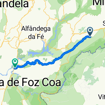
De Peredo de Bemposta a Freixo de Espada à Cinta
- -:--
- Duration
- 58.9 km
- Distance
- 1,157 m
- Ascent
- 1,339 m
- Descent
- ---
- Avg. speed
- ---
- Max. altitude

Route highlights
Points of interest along the route
Point of interest after 1.9 km
Pala dos Mouros
Point of interest after 3.4 km
Miradouro de Picões
Point of interest after 10.7 km
Miradouro Miguel Bravo
Point of interest after 10.7 km
Miradouro Miguel Bravo
Point of interest after 14.9 km
Aldeia de VILARINHO DOS GALEGOS
Point of interest after 19.8 km
Miradouro do Caminho do Rio
Point of interest after 22.4 km
Aldeia de BRUÇÓ
Point of interest after 33.2 km
Miradouro da Cruzinha
Point of interest after 34.6 km
Aldeia de LAGOAÇA
Point of interest after 37.8 km
Miradouro do Carrascalinho
Point of interest after 40.8 km
Aldeia de FORNOS
Point of interest after 49 km
Aldeia de MAZOUCO
Point of interest after 57.4 km
FREIXO DE ESPADA À CINTA
Continue with Bikemap
Use, edit, or download this cycling route
You would like to ride GR36 #2 or customize it for your own trip? Here is what you can do with this Bikemap route:
Free features
- Save this route as favorite or in collections
- Copy & plan your own version of this route
- Sync your route with Garmin or Wahoo
Premium features
Free trial for 3 days, or one-time payment. More about Bikemap Premium.
- Navigate this route on iOS & Android
- Export a GPX / KML file of this route
- Create your custom printout (try it for free)
- Download this route for offline navigation
Discover more Premium features.
Get Bikemap PremiumFrom our community
Other popular routes starting in Mogadouro
 Mogadouro - Vila Flor
- Distance
- 76.2 km
- Ascent
- 969 m
- Descent
- 1,172 m
- Location
- Mogadouro, Braganza District, Portugal
 P14 Mog to Zamora
- Distance
- 120 km
- Ascent
- 595 m
- Descent
- 658 m
- Location
- Mogadouro, Braganza District, Portugal
 Arribes_Duero_Etapa03
- Distance
- 141.7 km
- Ascent
- 2,776 m
- Descent
- 2,872 m
- Location
- Mogadouro, Braganza District, Portugal
 Tour 4 Vuelta 2012
- Distance
- 157 km
- Ascent
- 1,330 m
- Descent
- 1,999 m
- Location
- Mogadouro, Braganza District, Portugal
 portugal day 2
- Distance
- 125.3 km
- Ascent
- 1,796 m
- Descent
- 1,768 m
- Location
- Mogadouro, Braganza District, Portugal
 7 day (option 2)
- Distance
- 80.8 km
- Ascent
- 721 m
- Descent
- 716 m
- Location
- Mogadouro, Braganza District, Portugal
 9ème étape Bemposta/Vilanova Foz Coa
- Distance
- 75.8 km
- Ascent
- 697 m
- Descent
- 1,242 m
- Location
- Mogadouro, Braganza District, Portugal
 Mogadouro - Torre de Moncorvo
- Distance
- 62.5 km
- Ascent
- 1,051 m
- Descent
- 1,524 m
- Location
- Mogadouro, Braganza District, Portugal
Open it in the app