
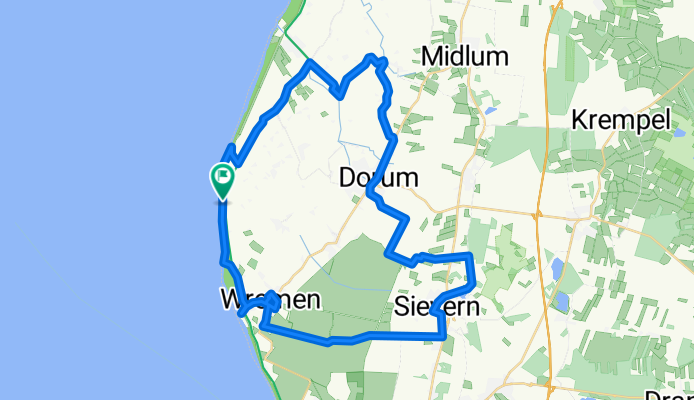
Wurster-Land-Route
Cycling route
Overview
About this route
<span style="font-size: 10pt; font-family: "Arial","sans-serif";">Der Name „Wurster-Land-Route“ erinnert an die Wurten, künstliche Hügel zum Schutz gegen die Fluten. Auf dieser Tour erleben Sie sehenswerte Kutterhäfen und das weite Land mit alten Kirchen, das Niedersächsische Deichmuseum, ein Museum für Wattenfischerei und das Nationalparkhaus.</span>
- -:--
- Duration
- 42.2 km
- Distance
- 18 m
- Ascent
- 15 m
- Descent
- ---
- Avg. speed
- ---
- Max. altitude

Route quality
Waytypes & surfaces along the route
Waytypes
Quiet road
21 km
(50 %)
Track
15.3 km
(36 %)
Surfaces
Paved
37.7 km
(89 %)
Unpaved
1.5 km
(4 %)
Asphalt
18 km
(43 %)
Paved (undefined)
11 km
(26 %)
Continue with Bikemap
Use, edit, or download this cycling route
You would like to ride Wurster-Land-Route or customize it for your own trip? Here is what you can do with this Bikemap route:
Free features
- Save this route as favorite or in collections
- Copy & plan your own version of this route
- Sync your route with Garmin or Wahoo
Premium features
Free trial for 3 days, or one-time payment. More about Bikemap Premium.
- Navigate this route on iOS & Android
- Export a GPX / KML file of this route
- Create your custom printout (try it for free)
- Download this route for offline navigation
Discover more Premium features.
Get Bikemap PremiumOpen it in the app