

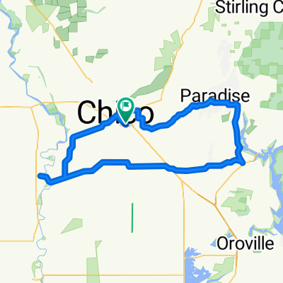
Alternate route to visit Sara
A cycling route starting in Chico, California, United States.
Overview
About this route
Through the Mountains! Covolo and the hill-route. Woo!
- -:--
- Duration
- 250.4 km
- Distance
- 2,883 m
- Ascent
- 2,555 m
- Descent
- ---
- Avg. speed
- ---
- Max. altitude
Route quality
Waytypes & surfaces along the route
Waytypes
Quiet road
35.1 km
(14 %)
Road
20 km
(8 %)
Surfaces
Paved
35.1 km
(14 %)
Unpaved
65.1 km
(26 %)
Unpaved (undefined)
57.6 km
(23 %)
Asphalt
32.6 km
(13 %)
Continue with Bikemap
Use, edit, or download this cycling route
You would like to ride Alternate route to visit Sara or customize it for your own trip? Here is what you can do with this Bikemap route:
Free features
- Save this route as favorite or in collections
- Copy & plan your own version of this route
- Split it into stages to create a multi-day tour
- Sync your route with Garmin or Wahoo
Premium features
Free trial for 3 days, or one-time payment. More about Bikemap Premium.
- Navigate this route on iOS & Android
- Export a GPX / KML file of this route
- Create your custom printout (try it for free)
- Download this route for offline navigation
Discover more Premium features.
Get Bikemap PremiumFrom our community
Other popular routes starting in Chico
 Willows - Dunnigan
- Distance
- 143.3 km
- Ascent
- 48 m
- Descent
- 94 m
- Location
- Chico, California, United States
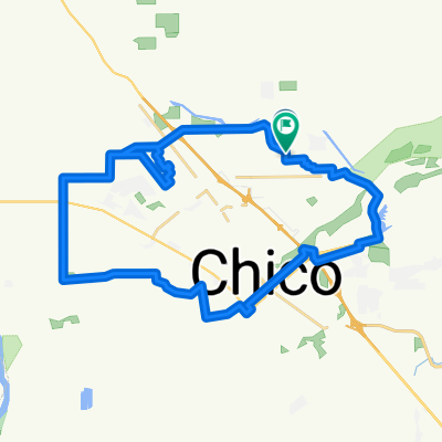
 Route in Chico
- Distance
- 4.6 km
- Ascent
- 8 m
- Descent
- 24 m
- Location
- Chico, California, United States
 2012 Lassen Trip Final Route
- Distance
- 506.4 km
- Ascent
- 3,923 m
- Descent
- 3,925 m
- Location
- Chico, California, United States
 Bicycle Harvest CLONED FROM ROUTE 690504
- Distance
- 35.7 km
- Ascent
- 146 m
- Descent
- 80 m
- Location
- Chico, California, United States
 Climb to Paradise
- Distance
- 21.8 km
- Ascent
- 511 m
- Descent
- 64 m
- Location
- Chico, California, United States
 Chico Mild-Flower
- Distance
- 109.4 km
- Ascent
- 799 m
- Descent
- 809 m
- Location
- Chico, California, United States
 Chico Circle
- Distance
- 39 km
- Ascent
- 52 m
- Descent
- 52 m
- Location
- Chico, California, United States
 Route to McKinleyville
- Distance
- 382.8 km
- Ascent
- 10,236 m
- Descent
- 10,252 m
- Location
- Chico, California, United States
Open it in the app