

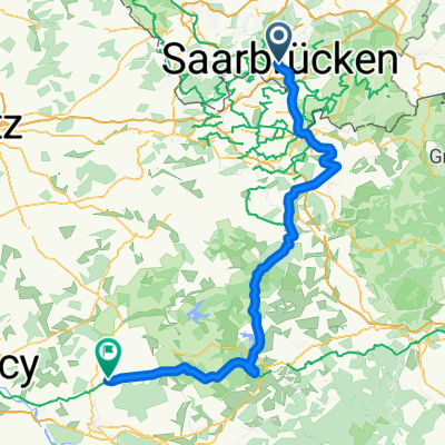
RTF 16. Jumelage Moselle-Saar 2008 RV Blitz Saarbrücken 1897 e.V. 83 km
A cycling route starting in Saarbrücken, Saarland, Germany.
Overview
About this route
- Moselle-Saar Twin 2008
RV Blitz Saarbrücken 1897 e.V. and
CoDEP 57 Moselle Bitche
83 km - route of the event on 28.09.2008
- -:--
- Duration
- 78.6 km
- Distance
- 855 m
- Ascent
- 900 m
- Descent
- ---
- Avg. speed
- 386 m
- Max. altitude

Route quality
Waytypes & surfaces along the route
Waytypes
Road
19.7 km
(25 %)
Quiet road
8.7 km
(11 %)
Surfaces
Paved
68.4 km
(87 %)
Unpaved
2.4 km
(3 %)
Asphalt
67.6 km
(86 %)
Gravel
1.6 km
(2 %)
Route highlights
Points of interest along the route
Point of interest after 17.6 km
Kontrolle Habskirchen
Point of interest after 42 km
Kontrolle Ormesviller
Continue with Bikemap
Use, edit, or download this cycling route
You would like to ride RTF 16. Jumelage Moselle-Saar 2008 RV Blitz Saarbrücken 1897 e.V. 83 km or customize it for your own trip? Here is what you can do with this Bikemap route:
Free features
- Save this route as favorite or in collections
- Copy & plan your own version of this route
- Sync your route with Garmin or Wahoo
Premium features
Free trial for 3 days, or one-time payment. More about Bikemap Premium.
- Navigate this route on iOS & Android
- Export a GPX / KML file of this route
- Create your custom printout (try it for free)
- Download this route for offline navigation
Discover more Premium features.
Get Bikemap PremiumFrom our community
Other popular routes starting in Saarbrücken
 Saarbrücken - Burgund - Loire - Guerande
- Distance
- 1,093.3 km
- Ascent
- 831 m
- Descent
- 995 m
- Location
- Saarbrücken, Saarland, Germany
 Längere Feierabend Runde
- Distance
- 61 km
- Ascent
- 540 m
- Descent
- 535 m
- Location
- Saarbrücken, Saarland, Germany
 RTF 16. Jumelage Moselle-Saar 2008 RV Blitz Saarbrücken 1897 e.V. 83 km
- Distance
- 78.6 km
- Ascent
- 855 m
- Descent
- 900 m
- Location
- Saarbrücken, Saarland, Germany
 SB nach Vaison la R. Chemin des Fontaines
- Distance
- 759.3 km
- Ascent
- 5,618 m
- Descent
- 5,541 m
- Location
- Saarbrücken, Saarland, Germany
 Saarbrücken - Bains-les-Bains
- Distance
- 251 km
- Ascent
- 2,396 m
- Descent
- 2,331 m
- Location
- Saarbrücken, Saarland, Germany
 Saarbrücken - Einville-au-Jard
- Distance
- 120 km
- Ascent
- 452 m
- Descent
- 433 m
- Location
- Saarbrücken, Saarland, Germany
 Sarrebruck/Nancy par les canaux
- Distance
- 150.1 km
- Ascent
- 194 m
- Descent
- 192 m
- Location
- Saarbrücken, Saarland, Germany
 Coal Mining South of the Saar - 16 Tower Tour
- Distance
- 61.8 km
- Ascent
- 582 m
- Descent
- 581 m
- Location
- Saarbrücken, Saarland, Germany
Open it in the app