

EV6 2021 ALLER 08 - Candé Saint-Avertin
A cycling route starting in Candé-sur-Beuvron, Centre-Val de Loire, France.
Overview
About this route
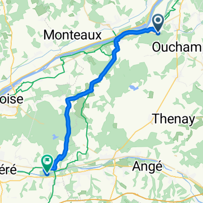
A08 - Candé-sur-Beuvron - Saint-Avertin Camping: At home :-)
- -:--
- Duration
- 48.9 km
- Distance
- 196 m
- Ascent
- 173 m
- Descent
- ---
- Avg. speed
- 107 m
- Max. altitude

Route quality
Waytypes & surfaces along the route
Waytypes
Quiet road
26.4 km
(54 %)
Road
4.9 km
(10 %)
Surfaces
Paved
22 km
(45 %)
Unpaved
2 km
(4 %)
Asphalt
22 km
(45 %)
Sand
2 km
(4 %)
Undefined
24.9 km
(51 %)
Continue with Bikemap
Use, edit, or download this cycling route
You would like to ride EV6 2021 ALLER 08 - Candé Saint-Avertin or customize it for your own trip? Here is what you can do with this Bikemap route:
Free features
- Save this route as favorite or in collections
- Copy & plan your own version of this route
- Sync your route with Garmin or Wahoo
Premium features
Free trial for 3 days, or one-time payment. More about Bikemap Premium.
- Navigate this route on iOS & Android
- Export a GPX / KML file of this route
- Create your custom printout (try it for free)
- Download this route for offline navigation
Discover more Premium features.
Get Bikemap PremiumFrom our community
Other popular routes starting in Candé-sur-Beuvron
 4. Candé-sur-Beuvron - Savonnières
- Distance
- 71.7 km
- Ascent
- 186 m
- Descent
- 222 m
- Location
- Candé-sur-Beuvron, Centre-Val de Loire, France
 Tag 3 Loire GPS-Track
- Distance
- 42 km
- Ascent
- 239 m
- Descent
- 245 m
- Location
- Candé-sur-Beuvron, Centre-Val de Loire, France
 Blois -Orleans
- Distance
- 78.2 km
- Ascent
- 99 m
- Descent
- 69 m
- Location
- Candé-sur-Beuvron, Centre-Val de Loire, France
 bike tour through Candé-sur-Beuvron
- Distance
- 14.8 km
- Ascent
- 83 m
- Descent
- 85 m
- Location
- Candé-sur-Beuvron, Centre-Val de Loire, France
 EV6 2021 ALLER 08 - Candé Saint-Avertin
- Distance
- 48.9 km
- Ascent
- 196 m
- Descent
- 173 m
- Location
- Candé-sur-Beuvron, Centre-Val de Loire, France
 De Route de Valaire 2B, Candé-sur-Beuvron à Unnamed Road, Chenonceaux
- Distance
- 30.7 km
- Ascent
- 262 m
- Descent
- 279 m
- Location
- Candé-sur-Beuvron, Centre-Val de Loire, France
 Muide sur Loire -- Chinon (Etape 2)
- Distance
- 45.9 km
- Ascent
- 164 m
- Descent
- 183 m
- Location
- Candé-sur-Beuvron, Centre-Val de Loire, France
 Blois-Tours (Amboise)
- Distance
- 53.9 km
- Ascent
- 146 m
- Descent
- 161 m
- Location
- Candé-sur-Beuvron, Centre-Val de Loire, France
Open it in the app