

Brewerton Rd, West Point to Old Ayers Rd, Tomkins Cove
A cycling route starting in West Point, New York, United States.
Overview
About this route
- 47 min
- Duration
- 16.6 km
- Distance
- 208 m
- Ascent
- 263 m
- Descent
- 21.4 km/h
- Avg. speed
- ---
- Max. altitude

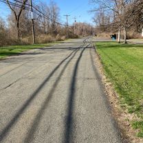
Route photos


Continue with Bikemap
Use, edit, or download this cycling route
You would like to ride Brewerton Rd, West Point to Old Ayers Rd, Tomkins Cove or customize it for your own trip? Here is what you can do with this Bikemap route:
Free features
- Save this route as favorite or in collections
- Copy & plan your own version of this route
- Sync your route with Garmin or Wahoo
Premium features
Free trial for 3 days, or one-time payment. More about Bikemap Premium.
- Navigate this route on iOS & Android
- Export a GPX / KML file of this route
- Create your custom printout (try it for free)
- Download this route for offline navigation
Discover more Premium features.
Get Bikemap PremiumFrom our community
Other popular routes starting in West Point
 79 St Basil's Rd, Garrison to Snook Rd, Fishkill
- Distance
- 28.6 km
- Ascent
- 547 m
- Descent
- 527 m
- Location
- West Point, New York, United States
 Jefferson Rd, West Point to 1–23 Columbus Cir, New York
- Distance
- 86.7 km
- Ascent
- 1,109 m
- Descent
- 1,126 m
- Location
- West Point, New York, United States
 cold spring short dirty loop
- Distance
- 29.8 km
- Ascent
- 611 m
- Descent
- 595 m
- Location
- West Point, New York, United States
 Brewerton Rd, West Point to Old Ayers Rd, Tomkins Cove
- Distance
- 16.6 km
- Ascent
- 208 m
- Descent
- 263 m
- Location
- West Point, New York, United States
 Garrison-Mt.Kisco
- Distance
- 68.5 km
- Ascent
- 860 m
- Descent
- 755 m
- Location
- West Point, New York, United States
 GWB to Bear Mountain to Garrison, NY
- Distance
- 87.8 km
- Ascent
- 1,100 m
- Descent
- 1,044 m
- Location
- West Point, New York, United States
Open it in the app