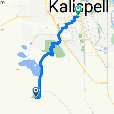
Smith Lake
A cycling route starting in Kalispell, Montana, United States of America.
Overview
About this route
- 45 min
- Duration
- 13.3 km
- Distance
- 50 m
- Ascent
- 26 m
- Descent
- 17.6 km/h
- Avg. speed
- ---
- Avg. speed
Route quality
Waytypes & surfaces along the route
Waytypes
Cycleway
11.9 km
(89 %)
Quiet road
1.4 km
(11 %)
Surfaces
Paved
11.9 km
(89 %)
Asphalt
11.9 km
(89 %)
Undefined
1.5 km
(11 %)
Continue with Bikemap
Use, edit, or download this cycling route
You would like to ride Smith Lake or customize it for your own trip? Here is what you can do with this Bikemap route:
Free features
- Save this route as favorite or in collections
- Copy & plan your own version of this route
- Sync your route with Garmin or Wahoo
Premium features
Free trial for 3 days, or one-time payment. More about Bikemap Premium.
- Navigate this route on iOS & Android
- Export a GPX / KML file of this route
- Create your custom printout (try it for free)
- Download this route for offline navigation
Discover more Premium features.
Get Bikemap PremiumFrom our community
Other popular routes starting in Kalispell
- Holt Stage - Many Lakes - Lake Blaine
- Distance
- 52.6 km
- Ascent
- 188 m
- Descent
- 185 m
- Location
- Kalispell, Montana, United States of America
- 540 W Arizona St, Kalispell to 540 W Arizona St, Kalispell
- Distance
- 5.2 km
- Ascent
- 33 m
- Descent
- 30 m
- Location
- Kalispell, Montana, United States of America
- Haskill Mountain
- Distance
- 43.8 km
- Ascent
- 1,084 m
- Descent
- 143 m
- Location
- Kalispell, Montana, United States of America
- Hwy 93 to Lower Valley
- Distance
- 33.8 km
- Ascent
- 53 m
- Descent
- 54 m
- Location
- Kalispell, Montana, United States of America
- Lower Valley - Foys - Lone Pine
- Distance
- 55.6 km
- Ascent
- 248 m
- Descent
- 248 m
- Location
- Kalispell, Montana, United States of America
- Kalispell to Whitefish, MT
- Distance
- 24.5 km
- Ascent
- 146 m
- Descent
- 123 m
- Location
- Kalispell, Montana, United States of America
- Kalispell - Somers
- Distance
- 31.2 km
- Ascent
- 68 m
- Descent
- 68 m
- Location
- Kalispell, Montana, United States of America
- Spring Creek - Fox Farm - KM Ranch - Whitefish
- Distance
- 68.8 km
- Ascent
- 321 m
- Descent
- 321 m
- Location
- Kalispell, Montana, United States of America