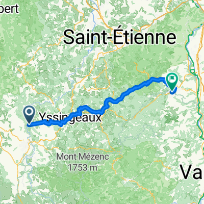
Pré Via Rhôna
- 108.6 km
- 823 m
- 1,241 m
- Rosières, Auvergne-Rhône-Alpes, France
A cycling route starting in Rosières, Auvergne-Rhône-Alpes, France.
Overview
De Lâvoute à Sarras, pour raccorder sur la Via Rhôna
created this 4 years ago
Route quality
Path
43.4 km
(40 %)
Quiet road
23.9 km
(22 %)
Paved
74.9 km
(69 %)
Unpaved
5.4 km
(5 %)
Asphalt
74.9 km
(69 %)
Gravel
5.4 km
(5 %)
Undefined
28.2 km
(26 %)
Continue with Bikemap
You would like to ride Pré Via Rhôna or customize it for your own trip? Here is what you can do with this Bikemap route:
Free trial for 3 days, or one-time payment. More about Bikemap Premium.
Discover more Premium features.
Get Bikemap PremiumFrom our community
Open it in the app