

Overview
About this route
- -:--
- Duration
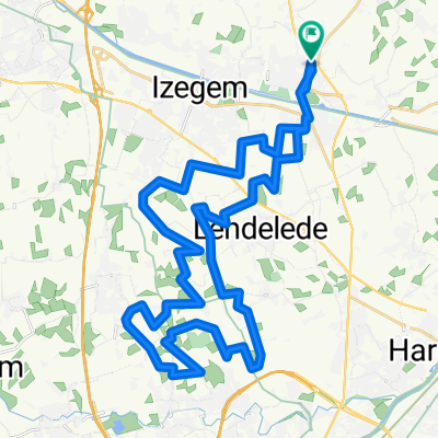
- 108 km
- Distance
- 75 m
- Ascent
- 74 m
- Descent
- ---
- Avg. speed
- ---
- Max. altitude

Part of
17 stages
Route quality
Waytypes & surfaces along the route
Waytypes
Quiet road
100.5 km
(93 %)
Road
3 km
(3 %)
Surfaces
Paved
20.8 km
(19 %)
Unpaved
0 km
(<1 %)
Asphalt
17.5 km
(16 %)
Concrete
3.3 km
(3 %)
Route highlights
Points of interest along the route

Point of interest after 5.1 km

Point of interest after 6 km
de nieuwe driehoek
Point of interest after 6 km
de hoevekip
Point of interest after 7.9 km
boerhof danny

Point of interest after 8.5 km
gevaarlijke oversteekplaats
Point of interest after 9 km
hobbelig stuk

Point of interest after 9.9 km
herentmolen
Point of interest after 10.4 km
zelfpluktuin
Point of interest after 11.7 km
dressuur

Point of interest after 14.7 km

Point of interest after 15.7 km
latexco

Point of interest after 17.4 km

Point of interest after 30.2 km
veldkruis
Point of interest after 32.6 km
ardoplant

Point of interest after 34.3 km
hazeveld
Point of interest after 36.4 km
weg in slechte staat

Point of interest after 38.3 km

Point of interest after 41.5 km
melanzane

Point of interest after 46.9 km
kapel van bijstand

Point of interest after 48.1 km

Point of interest after 54.3 km
deselec

Point of interest after 56 km
het fort
Point of interest after 56.1 km
carlu

Point of interest after 58.3 km

Point of interest after 60.1 km

Point of interest after 61 km
leegstaande villa
Point of interest after 61.8 km
asperges
Point of interest after 62.6 km
westorama
Point of interest after 62.7 km
geen doorgang
Point of interest after 64.2 km
macadam hobbelig
Point of interest after 66.2 km
macadam hobbelig
Point of interest after 67.3 km
macadam hobbelig

Point of interest after 71.4 km

Point of interest after 89.6 km
serres
Continue with Bikemap
Use, edit, or download this cycling route
You would like to ride meulebeke totaal 1-2-3-4 or customize it for your own trip? Here is what you can do with this Bikemap route:
Free features
- Save this route as favorite or in collections
- Copy & plan your own version of this route
- Split it into stages to create a multi-day tour
- Sync your route with Garmin or Wahoo
Premium features
Free trial for 3 days, or one-time payment. More about Bikemap Premium.
- Navigate this route on iOS & Android
- Export a GPX / KML file of this route
- Create your custom printout (try it for free)
- Download this route for offline navigation
Discover more Premium features.
Get Bikemap PremiumFrom our community
Other popular routes starting in Ingelmunster
 knooppunten 1 - 9
- Distance
- 356.4 km
- Ascent
- 112 m
- Descent
- 109 m
- Location
- Ingelmunster, Flemish Region, Belgium
 meulebekeZ3 - 35.7
- Distance
- 35.7 km
- Ascent
- 71 m
- Descent
- 71 m
- Location
- Ingelmunster, Flemish Region, Belgium
 meulebekeZ1 - 26.8
- Distance
- 26.8 km
- Ascent
- 42 m
- Descent
- 42 m
- Location
- Ingelmunster, Flemish Region, Belgium
 heule vandaag - 38.6
- Distance
- 38.6 km
- Ascent
- 120 m
- Descent
- 120 m
- Location
- Ingelmunster, Flemish Region, Belgium
 ardooieZ totaal
- Distance
- 303.8 km
- Ascent
- 504 m
- Descent
- 501 m
- Location
- Ingelmunster, Flemish Region, Belgium
 spelonkroute - 49.5
- Distance
- 49.5 km
- Ascent
- 57 m
- Descent
- 57 m
- Location
- Ingelmunster, Flemish Region, Belgium
 hulsteZ1 - 29.4
- Distance
- 29.3 km
- Ascent
- 108 m
- Descent
- 111 m
- Location
- Ingelmunster, Flemish Region, Belgium
 beitem1 - 39.2
- Distance
- 39.2 km
- Ascent
- 83 m
- Descent
- 83 m
- Location
- Ingelmunster, Flemish Region, Belgium
Open it in the app