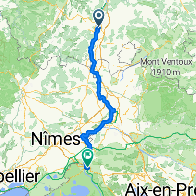
Montélimar - Bédoin (FR-MA10)
A cycling route starting in Châteauneuf-du-Rhône, Auvergne-Rhône-Alpes, France.
Overview
About this route
Montélimar - Bédoin
Freiburg - Marseille Etappe 9
- -:--
- Duration
- 101.5 km
- Distance
- 410 m
- Ascent
- 95 m
- Descent
- ---
- Avg. speed
- 386 m
- Avg. speed
Route quality
Waytypes & surfaces along the route
Waytypes
Quiet road
49.1 km
(48 %)
Path
14.9 km
(15 %)
Surfaces
Paved
80.4 km
(79 %)
Unpaved
0.3 km
(<1 %)
Asphalt
78.8 km
(78 %)
Concrete
1.2 km
(1 %)
Continue with Bikemap
Use, edit, or download this cycling route
You would like to ride Montélimar - Bédoin (FR-MA10) or customize it for your own trip? Here is what you can do with this Bikemap route:
Free features
- Save this route as favorite or in collections
- Copy & plan your own version of this route
- Sync your route with Garmin or Wahoo
Premium features
Free trial for 3 days, or one-time payment. More about Bikemap Premium.
- Navigate this route on iOS & Android
- Export a GPX / KML file of this route
- Create your custom printout (try it for free)
- Download this route for offline navigation
Discover more Premium features.
Get Bikemap PremiumFrom our community
Other popular routes starting in Châteauneuf-du-Rhône
- Day 7 (Châteauneuf-du-Rhône - Châteauneuf-du-pape)
- Distance
- 74.7 km
- Ascent
- 88 m
- Descent
- 120 m
- Location
- Châteauneuf-du-Rhône, Auvergne-Rhône-Alpes, France
- 9_Chateauneuf-du-Rhone - Vallabregues
- Distance
- 119.4 km
- Ascent
- 399 m
- Descent
- 475 m
- Location
- Châteauneuf-du-Rhône, Auvergne-Rhône-Alpes, France
- zomertoer 2019 velomobiel WAW413 rit 9
- Distance
- 117.2 km
- Ascent
- 254 m
- Descent
- 167 m
- Location
- Châteauneuf-du-Rhône, Auvergne-Rhône-Alpes, France
- Montélimar - Bédoin (FR-MA10)
- Distance
- 101.5 km
- Ascent
- 410 m
- Descent
- 95 m
- Location
- Châteauneuf-du-Rhône, Auvergne-Rhône-Alpes, France
- Châteauneuf du Rhône Bourg St Andéol
- Distance
- 23.5 km
- Ascent
- 97 m
- Descent
- 128 m
- Location
- Châteauneuf-du-Rhône, Auvergne-Rhône-Alpes, France
- EV17 - OGENS
- Distance
- 421.7 km
- Ascent
- 1,216 m
- Descent
- 652 m
- Location
- Châteauneuf-du-Rhône, Auvergne-Rhône-Alpes, France
- ViaRhôna
- Distance
- 35.5 km
- Ascent
- 167 m
- Descent
- 179 m
- Location
- Châteauneuf-du-Rhône, Auvergne-Rhône-Alpes, France
- bike tour through Châteauneuf-du-Rhône
- Distance
- 15.4 km
- Ascent
- 192 m
- Descent
- 192 m
- Location
- Châteauneuf-du-Rhône, Auvergne-Rhône-Alpes, France
Open it in the app