IM KRAICHGAU
- 89.7 km
- 652 m
- 628 m
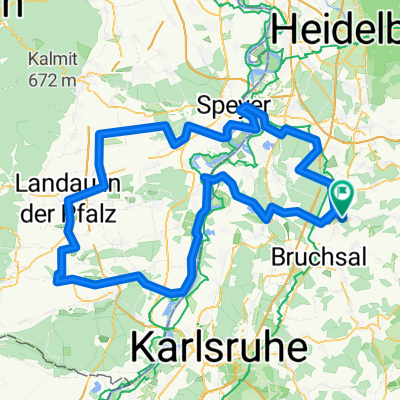
- Ubstadt-Weiher, Baden-Wurttemberg, Germany
A cycling route starting in Ubstadt-Weiher, Baden-Wurttemberg, Germany.
Overview
We start at the Agip gas station in Ubstadt and take the bike path towards Zeutern. At the height, we turn right and ride along the edge of the forest. On the left, there is an incredible view of the Rhine Plain all the way to the Palatinate Forest. After the Himmelreich Hut (it's worth a short stop here, the view is stunning), we turn right onto a narrow road down, keeping right at the end. We ride through Oberöwisheim, turn left at the train station, and follow the Kraichbach to Münzesheim. On the way back, we go back through Unteröwisheim to Ubstadt. Those who shy away from field paths should ride from Münzesheim on the bike path directly along the main road.
created this 17 years ago
Route quality
Track
8.1 km
(40 %)
Quiet road
6 km
(30 %)
Paved
14.5 km
(72 %)
Unpaved
3.6 km
(18 %)
Asphalt
13.5 km
(67 %)
Loose gravel
2 km
(10 %)
Continue with Bikemap
You would like to ride Rund um den Schmallenberg or customize it for your own trip? Here is what you can do with this Bikemap route:
Free trial for 3 days, or one-time payment. More about Bikemap Premium.
Discover more Premium features.
Get Bikemap PremiumFrom our community
Open it in the app