

DALMAC 2009 4 day east - Day 4 CLONED FROM ROUTE 308652
A cycling route starting in Gaylord, Michigan, United States.
Overview
About this route
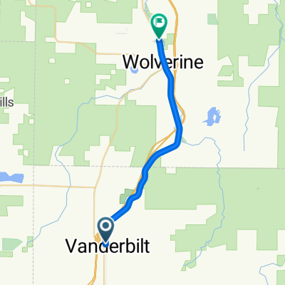
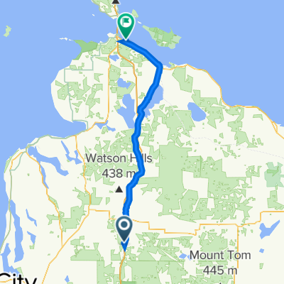
Gaylord to Mackinaw City. Steep hills leaving Topinabee and on Riggsville Road.
- -:--
- Duration
- 107.7 km
- Distance
- 178 m
- Ascent
- 405 m
- Descent
- ---
- Avg. speed
- ---
- Max. altitude
Continue with Bikemap
Use, edit, or download this cycling route
You would like to ride DALMAC 2009 4 day east - Day 4 CLONED FROM ROUTE 308652 or customize it for your own trip? Here is what you can do with this Bikemap route:
Free features
- Save this route as favorite or in collections
- Copy & plan your own version of this route
- Split it into stages to create a multi-day tour
- Sync your route with Garmin or Wahoo
Premium features
Free trial for 3 days, or one-time payment. More about Bikemap Premium.
- Navigate this route on iOS & Android
- Export a GPX / KML file of this route
- Create your custom printout (try it for free)
- Download this route for offline navigation
Discover more Premium features.
Get Bikemap PremiumFrom our community
Other popular routes starting in Gaylord
 Thirsty Sturgeon
- Distance
- 19.3 km
- Ascent
- 3 m
- Descent
- 105 m
- Location
- Gaylord, Michigan, United States
 Route from Jackson Alley, Gaylord
- Distance
- 111.8 km
- Ascent
- 279 m
- Descent
- 494 m
- Location
- Gaylord, Michigan, United States
 Lone Pine Road 2203, Gaylord to Lone Pine Road 2261, Gaylord
- Distance
- 0 km
- Ascent
- 0 m
- Descent
- 0 m
- Location
- Gaylord, Michigan, United States
 565 Crestwood Dr, Gaylord to 565 Crestwood Dr, Gaylord
- Distance
- 14.1 km
- Ascent
- 67 m
- Descent
- 76 m
- Location
- Gaylord, Michigan, United States
 Route to Jackson Alley, Gaylord
- Distance
- 1 km
- Ascent
- 17 m
- Descent
- 13 m
- Location
- Gaylord, Michigan, United States
 Recovered Route
- Distance
- 68.3 km
- Ascent
- 203 m
- Descent
- 409 m
- Location
- Gaylord, Michigan, United States
 DALMAC 2009 4 day east - Day 4 CLONED FROM ROUTE 308652
- Distance
- 107.7 km
- Ascent
- 178 m
- Descent
- 405 m
- Location
- Gaylord, Michigan, United States
 Long bike tour from Gaylord MI to Standish,MI
- Distance
- 160.9 km
- Ascent
- 211 m
- Descent
- 420 m
- Location
- Gaylord, Michigan, United States
Open it in the app