Grenzerfahrungen Teil 05 #BETA#
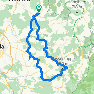
- 83.8 km
- 1,059 m
- 1,353 m
- Hofbieber, Hesse, Germany
Hessen
Point Alpha (westlichster Punkt der Grenze und potentieller Angriffspunkt für den 3.Weltkrieg
Unterkunft in Vacha o Dorndorf: http://www.werra-kanu.com/
http://www.wartburgkreis.de/gruenes_band/grossensee.html
http://de.wikipedia.org/wiki/Obersuhl
hier eventuell lieber den wanderweg nutzen?
Flußbiegung kann nach Lust/Zeit/Wetter gefahren werden (ca.5km)
Ruine
Gleisanlagen
sieht nach ner Felswand aus, eventuell östlich umfahren.
Übernachtung?! "Beim Schulland" (Fam. Heimroth)
Free trial for 3 days, or one-time payment. More about Bikemap Premium.
Discover more Premium features.
Get Bikemap PremiumOpen it in the app