

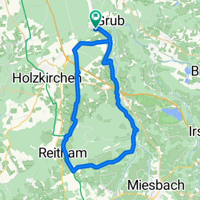
1988_Kreuzstraße_Holzkirchen (Radlrallye)
A cycling route starting in Valley, Bavaria, Germany.
Overview
About this route
Bike search and quiz rally by Herbert D.
- -:--
- Duration
- 27 km
- Distance
- 118 m
- Ascent
- 119 m
- Descent
- ---
- Avg. speed
- ---
- Max. altitude

Route quality
Waytypes & surfaces along the route
Waytypes
Quiet road
14.6 km
(54 %)
Road
10.5 km
(39 %)
Surfaces
Paved
26.7 km
(99 %)
Asphalt
26.7 km
(99 %)
Undefined
0.3 km
(1 %)
Continue with Bikemap
Use, edit, or download this cycling route
You would like to ride 1988_Kreuzstraße_Holzkirchen (Radlrallye) or customize it for your own trip? Here is what you can do with this Bikemap route:
Free features
- Save this route as favorite or in collections
- Copy & plan your own version of this route
- Sync your route with Garmin or Wahoo
Premium features
Free trial for 3 days, or one-time payment. More about Bikemap Premium.
- Navigate this route on iOS & Android
- Export a GPX / KML file of this route
- Create your custom printout (try it for free)
- Download this route for offline navigation
Discover more Premium features.
Get Bikemap PremiumFrom our community
Other popular routes starting in Valley
 Kreuzstraße - Spitzing - Kreuzstraße
- Distance
- 103.6 km
- Ascent
- 1,433 m
- Descent
- 1,447 m
- Location
- Valley, Bavaria, Germany
 13.03.02 Kl. Mangfalltalwanderung von Hohendilching nach Grub
- Distance
- 5.6 km
- Ascent
- 152 m
- Descent
- 154 m
- Location
- Valley, Bavaria, Germany
 reisenthal_Grub_Mangfall
- Distance
- 19.9 km
- Ascent
- 344 m
- Descent
- 344 m
- Location
- Valley, Bavaria, Germany
 Unterdarching zum Tegernsee, M-Wasserweg
- Distance
- 44.7 km
- Ascent
- 635 m
- Descent
- 637 m
- Location
- Valley, Bavaria, Germany
 OBY erf 21
- Distance
- 38.5 km
- Ascent
- 275 m
- Descent
- 274 m
- Location
- Valley, Bavaria, Germany
 Grubmühle - Maxlmühle, an der Mangfall
- Distance
- 18.8 km
- Ascent
- 549 m
- Descent
- 547 m
- Location
- Valley, Bavaria, Germany
 1988_Kreuzstraße_Holzkirchen (Radlrallye)
- Distance
- 27 km
- Ascent
- 118 m
- Descent
- 119 m
- Location
- Valley, Bavaria, Germany
 50km Kreuzstr. Schaftlach Kirchsee
- Distance
- 47.9 km
- Ascent
- 378 m
- Descent
- 351 m
- Location
- Valley, Bavaria, Germany
Open it in the app