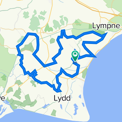
Channel 50 Challenge
A cycling route starting in Romney Marsh, England, United Kingdom.
Overview
About this route
Sunday 7th July 2024. Channel 50 Challenge - Starts and finishes at St Mary in the Marsh -
Circular Routes on Kent’s Romney Marsh. Great for the serious cyclist, family or just the challenge of riding 30, 50 or 80 miles (50 & 30 mile route together).
- -:--
- Duration
- 78.7 km
- Distance
- 92 m
- Ascent
- 96 m
- Descent
- ---
- Avg. speed
- 43 m
- Avg. speed
Route quality
Waytypes & surfaces along the route
Waytypes
Quiet road
40.5 km
(51 %)
Road
31.5 km
(40 %)
Surfaces
Paved
54.7 km
(70 %)
Asphalt
54.7 km
(70 %)
Undefined
24 km
(30 %)
Route highlights
Points of interest along the route
Point of interest after 2.4 km
Waypoint 1 Right Turn. Marshals stationed here.
Point of interest after 4 km
Waypoint 2 Sharp Left Turn. Marshalls stationed here.
Point of interest after 7.4 km
Waypoint 3 SHARP LEFT TURN, Caution. Marshalls stationed here.
Point of interest after 10.8 km
Waypoint 4 Right Turn
Point of interest after 11.8 km
Waypoint 5 Continue Straight on.
Point of interest after 14 km
Waypoint 6 Sharp Left Turn.
Point of interest after 16.6 km
Waypoint 7 Left Turn.
Point of interest after 22.9 km
Waypoint 8 A double junction first turn LEFT then turn RIGHT
Point of interest after 23.9 km
Waypoint 9 Right Turn
Point of interest after 24.6 km
Waypoint 10 Left Turn
Point of interest after 25.9 km
Waypoint 11 Right Turn.
Point of interest after 26.5 km
Waypoint 12 Straight on.
Point of interest after 27.4 km
Waypoint 13 LEFT turn before canal bridge.
Point of interest after 29.8 km
Waypoint 14 Left Turn
Point of interest after 30.1 km
Waypoint 15 Straight on
Point of interest after 31.5 km
Waypoint 16 RIGHT TURN, Difficult sight line. CAUTION. Marshalls Stationed Here.
Point of interest after 34.2 km
Waypoint 17 Left Turn
Point of interest after 34.8 km
Waypoint 18 Straight on into Ivychurch
Point of interest after 35 km
Waypoint 19 Right Turn, Good sightlines
Point of interest after 35.1 km
Ivychurch Village Hall Refreshment Stop
Point of interest after 36.5 km
Waypoint 20 Straight on.
Point of interest after 37.7 km
Waypoint 21 Difficult Junction. Need to join traffic on A 2070 and then take the THIRD EXIT off the roundabout, direction Appledore, on B 2080 Marshalls stationed here.
Point of interest after 38.2 km
Waypoint 22 Straight across roundabout
Point of interest after 40.8 km
Waypoint 23 Right Turn, Caution Traffic.
Point of interest after 41.7 km
Waypoint 24 Straight on.
Point of interest after 43.7 km
CAUTION RAILWAY CROSSING
Point of interest after 44.7 km
Waypoint 25 Double left turn. Marshals stationed here.
Point of interest after 46.2 km
Waypoint 26 Left Turn
Point of interest after 47.5 km
Waypoint 27 Straight on.
Point of interest after 48.3 km
Waypoint 28 Straight on.
Point of interest after 49.4 km
Waypoint 29 Difficult Left Turn. Caution. Poor Sight Lines.
Point of interest after 50 km
Waypoint 30 Straight on.
Point of interest after 50.7 km
Waypoint 31. Difficult RIGHT turn, but Good sightlines. Marshals stationed here
Point of interest after 53.5 km
CAUTION RAILWAY CROSSING
Point of interest after 54.5 km
Waypoint 32 Straight on.
Point of interest after 55.2 km
Waypoint 33 Left Turn, Caution Farm Entrance just after turn.
Point of interest after 55.8 km
Waypoint 34 Straight on.
Point of interest after 56.1 km
Waypoint 35 Straight on
Point of interest after 56.5 km
Waypoint 35a Turn Left. CAUTION you are joining a very fast road.
Point of interest after 57.7 km
Waypoint 36 Enter roundabout and take the 4th exit
Point of interest after 57.9 km
Turn Right WP 36A
Point of interest after 58 km
Turn left WP 37
Point of interest after 58.1 km
Waypoint 37A Right turn into Clubbs Lane
Point of interest after 59 km
Waypoint 38 Right Turn
Point of interest after 59.7 km
Waypoint 39 Left Turn
Point of interest after 61.4 km
Waypoint 39A Straight on.
Point of interest after 62.9 km
Waypoint 40 Straight on.
Point of interest after 64.9 km
Waypoint 41 Right Turn
Point of interest after 66.8 km
Waypoint 42 Left Turn
Point of interest after 67.3 km
CAUTION RAILWAY CROSSING WITH NO BARRIERS.
Point of interest after 70.3 km
Waypoint 43 Please use cycle crossing point of busy A 259. Marshals stationed here
Point of interest after 71.9 km
Waypoint 44 Right Turn. Traffic coming from YOUR Left has poor sightlines over Bridge.
Point of interest after 74.8 km
Waypoint 45 Left Turn
Point of interest after 75.3 km
Waypoint 46 Road drifts to the right
Point of interest after 75.6 km
Waypoint 47 Straight on
Point of interest after 75.9 km
Waypoint 48 Sharp LEFT turn on new road layout. CAUTION.
Point of interest after 77.4 km
Waypoint 49 Left Turn
Point of interest after 78.4 km
Waypoint 50 Right Turn
Continue with Bikemap
Use, edit, or download this cycling route
You would like to ride Channel 50 Challenge or customize it for your own trip? Here is what you can do with this Bikemap route:
Free features
- Save this route as favorite or in collections
- Copy & plan your own version of this route
- Sync your route with Garmin or Wahoo
Premium features
Free trial for 3 days, or one-time payment. More about Bikemap Premium.
- Navigate this route on iOS & Android
- Export a GPX / KML file of this route
- Create your custom printout (try it for free)
- Download this route for offline navigation
Discover more Premium features.
Get Bikemap PremiumFrom our community
Other popular routes starting in Romney Marsh
- Lydd way
- Distance
- 25.4 km
- Ascent
- 9 m
- Descent
- 4 m
- Location
- Romney Marsh, England, United Kingdom
- Star Inn
- Distance
- 12.3 km
- Ascent
- 0 m
- Descent
- 13 m
- Location
- Romney Marsh, England, United Kingdom
- Romney Marsh Circuit
- Distance
- 55.4 km
- Ascent
- 22 m
- Descent
- 21 m
- Location
- Romney Marsh, England, United Kingdom
- Channel 30 Challenge
- Distance
- 43.1 km
- Ascent
- 0 m
- Descent
- 4 m
- Location
- Romney Marsh, England, United Kingdom
- Channel 50 Challenge
- Distance
- 78.7 km
- Ascent
- 92 m
- Descent
- 96 m
- Location
- Romney Marsh, England, United Kingdom
- Pickneybush Lane, St. Mary In The Marsh, Romney Marsh to Cap Gris Nez, Hilders Cliff, Rye
- Distance
- 25.4 km
- Ascent
- 3 m
- Descent
- 3 m
- Location
- Romney Marsh, England, United Kingdom
- Channel C70 v2
- Distance
- 112.1 km
- Ascent
- 94 m
- Descent
- 96 m
- Location
- Romney Marsh, England, United Kingdom
- Channel 100/50 Challenge Ride
- Distance
- 78.4 km
- Ascent
- 80 m
- Descent
- 82 m
- Location
- Romney Marsh, England, United Kingdom
Open it in the app