

zeitfahrstrecke
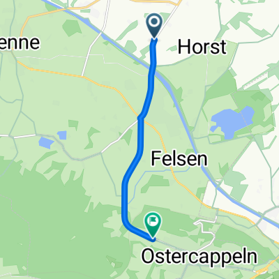
A cycling route starting in Ostercappeln, Lower Saxony, Germany.
Overview
About this route
Strecke als Trainingskurs für "Rosdoer"
- -:--
- Duration
- 4.7 km
- Distance
- 55 m
- Ascent
- 9 m
- Descent
- ---
- Avg. speed
- ---
- Max. altitude

Route quality
Waytypes & surfaces along the route
Waytypes
Path
2.7 km
(57 %)
Road
1.9 km
(39 %)
Surfaces
Paved
0.6 km
(13 %)
Asphalt
0.6 km
(13 %)
Undefined
4.1 km
(87 %)
Continue with Bikemap
Use, edit, or download this cycling route
You would like to ride zeitfahrstrecke or customize it for your own trip? Here is what you can do with this Bikemap route:
Free features
- Save this route as favorite or in collections
- Copy & plan your own version of this route
- Sync your route with Garmin or Wahoo
Premium features
Free trial for 3 days, or one-time payment. More about Bikemap Premium.
- Navigate this route on iOS & Android
- Export a GPX / KML file of this route
- Create your custom printout (try it for free)
- Download this route for offline navigation
Discover more Premium features.
Get Bikemap PremiumFrom our community
Other popular routes starting in Ostercappeln
 Kalkriese-Gut Arentshorst-Venner Moor-Kalkriese
- Distance
- 38.1 km
- Ascent
- 105 m
- Descent
- 106 m
- Location
- Ostercappeln, Lower Saxony, Germany
 Schloss Hünnefeld, Burg Witlage - Schwagstorf 34,4km
- Distance
- 34.2 km
- Ascent
- 66 m
- Descent
- 67 m
- Location
- Ostercappeln, Lower Saxony, Germany
 Schloss Hünnefeld - Venne: 41km
- Distance
- 37.9 km
- Ascent
- 60 m
- Descent
- 62 m
- Location
- Ostercappeln, Lower Saxony, Germany
 Niewedde Golfclub Varus, Damme Rundfahrt 1
- Distance
- 44.5 km
- Ascent
- 41 m
- Descent
- 40 m
- Location
- Ostercappeln, Lower Saxony, Germany
 venne-dümmer-venne
- Distance
- 54.9 km
- Ascent
- 50 m
- Descent
- 42 m
- Location
- Ostercappeln, Lower Saxony, Germany
 Von Kalkriese nach Bad Essen
- Distance
- 19.9 km
- Ascent
- 25 m
- Descent
- 23 m
- Location
- Ostercappeln, Lower Saxony, Germany
 Maitour 08.05.2011
- Distance
- 53.5 km
- Ascent
- 169 m
- Descent
- 169 m
- Location
- Ostercappeln, Lower Saxony, Germany
 zeitfahrstrecke
- Distance
- 4.7 km
- Ascent
- 55 m
- Descent
- 9 m
- Location
- Ostercappeln, Lower Saxony, Germany
Open it in the app