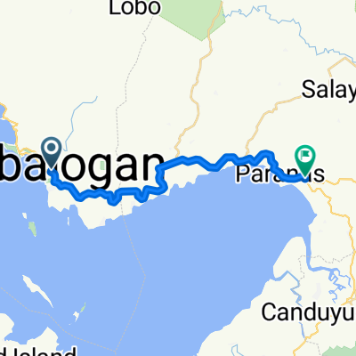


Catbalogan Off road(Lagundi-Cawayan_StoNino)
- 14.3 km
- 447 m
- 451 m
- Catbalogan, Region VIII, Philippines
A cycling route starting in Catbalogan, Region VIII, Philippines.
Overview
created this 4 years ago

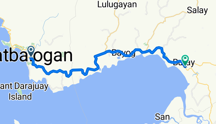
Route quality
Cycleway
23.4 km
(95 %)
Undefined
1.2 km
(5 %)
Paved
15.7 km
(64 %)
Asphalt
14.5 km
(59 %)
Concrete
1.2 km
(5 %)
Undefined
8.9 km
(36 %)
Continue with Bikemap
You would like to ride Daang Maharlika Highway, Catbalogan City to Daang Maharlika Highway, Paranas or customize it for your own trip? Here is what you can do with this Bikemap route:
Free trial for 3 days, or one-time payment. More about Bikemap Premium.
Discover more Premium features.
Get Bikemap PremiumFrom our community
Open it in the app