

Brenner-Drauradweg-Maribor-Wien
A cycling route starting in Ried, Trentino-Alto Adige, Italy.
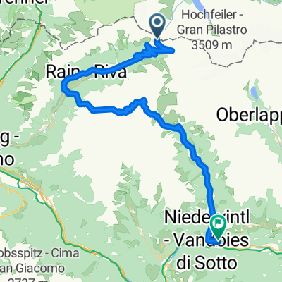
Overview
About this route
- -:--
- Duration
- 803.5 km
- Distance
- 12,425 m
- Ascent
- 13,602 m
- Descent
- ---
- Avg. speed
- ---
- Max. altitude

Route quality
Waytypes & surfaces along the route
Waytypes
Quiet road
249.1 km
(31 %)
Cycleway
192.8 km
(24 %)
Surfaces
Paved
562.5 km
(70 %)
Unpaved
120.5 km
(15 %)
Asphalt
538.3 km
(67 %)
Gravel
72.3 km
(9 %)
Continue with Bikemap
Use, edit, or download this cycling route
You would like to ride Brenner-Drauradweg-Maribor-Wien or customize it for your own trip? Here is what you can do with this Bikemap route:
Free features
- Save this route as favorite or in collections
- Copy & plan your own version of this route
- Split it into stages to create a multi-day tour
- Sync your route with Garmin or Wahoo
Premium features
Free trial for 3 days, or one-time payment. More about Bikemap Premium.
- Navigate this route on iOS & Android
- Export a GPX / KML file of this route
- Create your custom printout (try it for free)
- Download this route for offline navigation
Discover more Premium features.
Get Bikemap PremiumFrom our community
Other popular routes starting in Ried
 AlpX 2013 Tag 3
- Distance
- 73.2 km
- Ascent
- 1,490 m
- Descent
- 2,844 m
- Location
- Ried, Trentino-Alto Adige, Italy
 Trans-Alp 2. Etappe
- Distance
- 73.1 km
- Ascent
- 2,964 m
- Descent
- 2,193 m
- Location
- Ried, Trentino-Alto Adige, Italy
 Transalp 2011 Tag 3
- Distance
- 75.2 km
- Ascent
- 1,981 m
- Descent
- 2,021 m
- Location
- Ried, Trentino-Alto Adige, Italy
 Brenner - Thal-Aue/Assling
- Distance
- 142.2 km
- Ascent
- 601 m
- Descent
- 1,133 m
- Location
- Ried, Trentino-Alto Adige, Italy
 Tag 4. Alternative Sct. Jacob - Zell am Ziller
- Distance
- 70 km
- Ascent
- 1,807 m
- Descent
- 2,786 m
- Location
- Ried, Trentino-Alto Adige, Italy
 Pfitscher Joch -vintl
- Distance
- 55.8 km
- Ascent
- 1,192 m
- Descent
- 2,698 m
- Location
- Ried, Trentino-Alto Adige, Italy
 A, Tirol, Brenner - Mieders
- Distance
- 28.5 km
- Ascent
- 102 m
- Descent
- 523 m
- Location
- Ried, Trentino-Alto Adige, Italy
 day 10 alternative part 1
- Distance
- 27.6 km
- Ascent
- 958 m
- Descent
- 412 m
- Location
- Ried, Trentino-Alto Adige, Italy
Open it in the app