

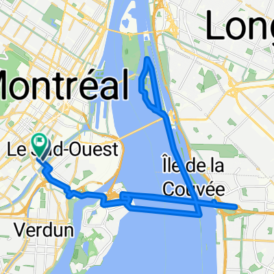
Sainte-Martine
A cycling route starting in Westmount, Quebec, Canada.
Overview
About this route
- -:--
- Duration
- 121.5 km
- Distance
- 90 m
- Ascent
- 94 m
- Descent
- ---
- Avg. speed
- ---
- Max. altitude

Route quality
Waytypes & surfaces along the route
Waytypes
Road
36.5 km
(30 %)
Quiet road
25.5 km
(21 %)
Surfaces
Paved
83.8 km
(69 %)
Asphalt
62 km
(51 %)
Paved (undefined)
21.9 km
(18 %)
Undefined
37.7 km
(31 %)
Continue with Bikemap
Use, edit, or download this cycling route
You would like to ride Sainte-Martine or customize it for your own trip? Here is what you can do with this Bikemap route:
Free features
- Save this route as favorite or in collections
- Copy & plan your own version of this route
- Split it into stages to create a multi-day tour
- Sync your route with Garmin or Wahoo
Premium features
Free trial for 3 days, or one-time payment. More about Bikemap Premium.
- Navigate this route on iOS & Android
- Export a GPX / KML file of this route
- Create your custom printout (try it for free)
- Download this route for offline navigation
Discover more Premium features.
Get Bikemap PremiumFrom our community
Other popular routes starting in Westmount
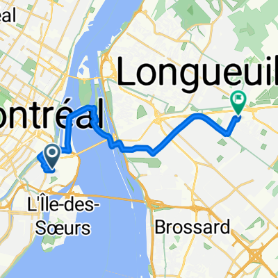
 Rue Stayner, Westmount to Boul Dorchester O, Westmount
- Distance
- 44.5 km
- Ascent
- 97 m
- Descent
- 97 m
- Location
- Westmount, Quebec, Canada
 Mount Pleasant
- Distance
- 2 km
- Ascent
- 133 m
- Descent
- 0 m
- Location
- Westmount, Quebec, Canada
 Rue Ste-Cunégonde, Montréal à Rue Ste-Cunégonde, Montréal
- Distance
- 41.7 km
- Ascent
- 179 m
- Descent
- 181 m
- Location
- Westmount, Quebec, Canada
 Rue de la Congrégation, Montréal à Boul Losch, Longueuil
- Distance
- 16.6 km
- Ascent
- 48 m
- Descent
- 38 m
- Location
- Westmount, Quebec, Canada
 mcgill route
- Distance
- 4.2 km
- Ascent
- 35 m
- Descent
- 95 m
- Location
- Westmount, Quebec, Canada
 Circuit UdeM
- Distance
- 2.3 km
- Ascent
- 55 m
- Descent
- 52 m
- Location
- Westmount, Quebec, Canada
 Sainte-Martine
- Distance
- 121.5 km
- Ascent
- 90 m
- Descent
- 94 m
- Location
- Westmount, Quebec, Canada
 Parcours moyen MTL
- Distance
- 19.9 km
- Ascent
- 444 m
- Descent
- 443 m
- Location
- Westmount, Quebec, Canada
Open it in the app