

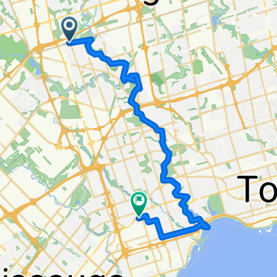
San Gabriele Place 9, Toronto to Stanley Avenue 5879-5899, Niagara Falls
A cycling route starting in Concord, Ontario, Canada.
Overview
About this route
- 6 h 50 min
- Duration
- 136 km
- Distance
- 563 m
- Ascent
- 526 m
- Descent
- 19.9 km/h
- Avg. speed
- ---
- Max. altitude

Route quality
Waytypes & surfaces along the route
Waytypes
Busy road
44.3 km
(33 %)
Road
30.9 km
(23 %)
Surfaces
Paved
123.1 km
(91 %)
Unpaved
1.6 km
(1 %)
Asphalt
120 km
(88 %)
Paved (undefined)
2.4 km
(2 %)
Continue with Bikemap
Use, edit, or download this cycling route
You would like to ride San Gabriele Place 9, Toronto to Stanley Avenue 5879-5899, Niagara Falls or customize it for your own trip? Here is what you can do with this Bikemap route:
Free features
- Save this route as favorite or in collections
- Copy & plan your own version of this route
- Split it into stages to create a multi-day tour
- Sync your route with Garmin or Wahoo
Premium features
Free trial for 3 days, or one-time payment. More about Bikemap Premium.
- Navigate this route on iOS & Android
- Export a GPX / KML file of this route
- Create your custom printout (try it for free)
- Download this route for offline navigation
Discover more Premium features.
Get Bikemap PremiumFrom our community
Other popular routes starting in Concord
 humber river
- Distance
- 37.1 km
- Ascent
- 397 m
- Descent
- 455 m
- Location
- Concord, Ontario, Canada
 Downsview Park to Claireville Ranch and BAPS
- Distance
- 50.2 km
- Ascent
- 306 m
- Descent
- 307 m
- Location
- Concord, Ontario, Canada
 Pioneer Village to Union Station Via Humber River and Martin Goodman Trails
- Distance
- 45.4 km
- Ascent
- 281 m
- Descent
- 393 m
- Location
- Concord, Ontario, Canada
 Downsview Park to Malton Via West Humber and Claireville Ranch
- Distance
- 45.3 km
- Ascent
- 255 m
- Descent
- 279 m
- Location
- Concord, Ontario, Canada
 San Gabriele Place 9, Toronto to Stanley Avenue 5879-5899, Niagara Falls
- Distance
- 136 km
- Ascent
- 563 m
- Descent
- 526 m
- Location
- Concord, Ontario, Canada
 De Shoreham Drive 30, Toronto a Martin Goodman Trail, Toronto
- Distance
- 27.3 km
- Ascent
- 260 m
- Descent
- 369 m
- Location
- Concord, Ontario, Canada
 Humber Recreational Trail
- Distance
- 24.5 km
- Ascent
- 73 m
- Descent
- 143 m
- Location
- Concord, Ontario, Canada
 kcc100
- Distance
- 105.2 km
- Ascent
- 345 m
- Descent
- 343 m
- Location
- Concord, Ontario, Canada
Open it in the app