

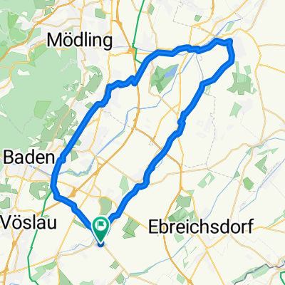
Tattendorf
A cycling route starting in Tattendorf, Lower Austria, Austria.
Overview
About this route
- -:--
- Duration
- 87.7 km
- Distance
- 261 m
- Ascent
- 258 m
- Descent
- ---
- Avg. speed
- ---
- Max. altitude

Route quality
Waytypes & surfaces along the route
Waytypes
Quiet road
27.2 km
(31 %)
Track
21.9 km
(25 %)
Surfaces
Paved
57 km
(65 %)
Unpaved
11.4 km
(13 %)
Asphalt
55.2 km
(63 %)
Gravel
7.9 km
(9 %)
Continue with Bikemap
Use, edit, or download this cycling route
You would like to ride Tattendorf or customize it for your own trip? Here is what you can do with this Bikemap route:
Free features
- Save this route as favorite or in collections
- Copy & plan your own version of this route
- Split it into stages to create a multi-day tour
- Sync your route with Garmin or Wahoo
Premium features
Free trial for 3 days, or one-time payment. More about Bikemap Premium.
- Navigate this route on iOS & Android
- Export a GPX / KML file of this route
- Create your custom printout (try it for free)
- Download this route for offline navigation
Discover more Premium features.
Get Bikemap PremiumFrom our community
Other popular routes starting in Tattendorf
 Baden 1
- Distance
- 118 km
- Ascent
- 1,391 m
- Descent
- 1,394 m
- Location
- Tattendorf, Lower Austria, Austria
 Tattendorf
- Distance
- 87.7 km
- Ascent
- 261 m
- Descent
- 258 m
- Location
- Tattendorf, Lower Austria, Austria
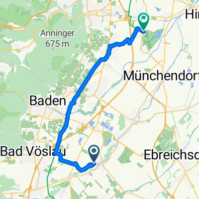
 Harzberg Runde
- Distance
- 28.3 km
- Ascent
- 370 m
- Descent
- 368 m
- Location
- Tattendorf, Lower Austria, Austria
 Pottendorfer Straße 4, Tattendorf nach Eisenstädter Straße 10, Wimpassing an der Leitha
- Distance
- 12.7 km
- Ascent
- 8 m
- Descent
- 27 m
- Location
- Tattendorf, Lower Austria, Austria
 Radweg Runde
- Distance
- 46.6 km
- Ascent
- 68 m
- Descent
- 68 m
- Location
- Tattendorf, Lower Austria, Austria
 Sollenauerstraße 1, Blumau nach Unnamed Road
- Distance
- 6.8 km
- Ascent
- 5 m
- Descent
- 25 m
- Location
- Tattendorf, Lower Austria, Austria
 Testtitel :P sdflfsdjlkdsf alsdu skjfjsdf fj sdjfsdfjksdf osidjf osdjf okj osidflksj dofi sdfj oifj oiadsjfo aisjdoifj aosijf ioasjd foijasoif isajdfo iajsdfo i
- Distance
- 34.4 km
- Ascent
- 100 m
- Descent
- 74 m
- Location
- Tattendorf, Lower Austria, Austria
 Aussiedlerhof nach Neudorfer Straße 1, Laxenburg
- Distance
- 22 km
- Ascent
- 57 m
- Descent
- 106 m
- Location
- Tattendorf, Lower Austria, Austria
Open it in the app