
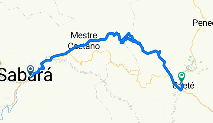
E.R. Sabarabuçu - Sabará - Caeté (Atalho)
A cycling route starting in Raposos, Minas Gerais, Brazil.
Overview
About this route
Estrada Real - Via Sabarabuçu - Sabará - Caeté.
Atalho na brita da antiga estrada de ferro, passando pelo estradão até o asfalto.
- -:--
- Duration
- 31.6 km
- Distance
- 421 m
- Ascent
- 206 m
- Descent
- ---
- Avg. speed
- ---
- Max. altitude
Route highlights
Points of interest along the route
Point of interest after 16.4 km
Ponte sobre o rio. Após atrevessá-la tem um marco. Siga a indicação sempre margeando o rio à esquerda.
Point of interest after 18.6 km
Túnel. Se você chegar até aqui, volte (rs). O correto é seguir no sentido contrário, até terminar a brita. No estradão, vire a direita e suba em frente.
Point of interest after 20.4 km
Estrada de brita. De cada lado da via tem um marco. Eles estão com as indicações invertidas. O correto é fazer o sentido contrário ao indicado. Se você chegar em um túnel, volte. Deste marco, pela brita, você deve andar aproximados 300m até o estradão. Vire a sua direita, sempre subindo pelo estradão. Você chegará ao asfalto.
Continue with Bikemap
Use, edit, or download this cycling route
You would like to ride E.R. Sabarabuçu - Sabará - Caeté (Atalho) or customize it for your own trip? Here is what you can do with this Bikemap route:
Free features
- Save this route as favorite or in collections
- Copy & plan your own version of this route
- Sync your route with Garmin or Wahoo
Premium features
Free trial for 3 days, or one-time payment. More about Bikemap Premium.
- Navigate this route on iOS & Android
- Export a GPX / KML file of this route
- Create your custom printout (try it for free)
- Download this route for offline navigation
Discover more Premium features.
Get Bikemap PremiumFrom our community
Other popular routes starting in Raposos
 Sabará - cachoeira Santo Antônio
- Distance
- 55.2 km
- Ascent
- 1,273 m
- Descent
- 1,269 m
- Location
- Raposos, Minas Gerais, Brazil
![Sabará > Raposos (Poço Azul) [Inicio]](https://media.bikemap.net/routes/1807267/staticmaps/in_bd7d11d9-4dee-42da-bbca-1c1468e4c172_400x400_bikemap-2021-3D-static.png) Sabará > Raposos (Poço Azul) [Inicio]
Sabará > Raposos (Poço Azul) [Inicio]- Distance
- 7.6 km
- Ascent
- 204 m
- Descent
- 149 m
- Location
- Raposos, Minas Gerais, Brazil
 Sabará - Morro Vermelho - Caeté (Rota do Ferro)
- Distance
- 49.8 km
- Ascent
- 711 m
- Descent
- 716 m
- Location
- Raposos, Minas Gerais, Brazil
 Espinhozinho - Sabará
- Distance
- 27.1 km
- Ascent
- 553 m
- Descent
- 553 m
- Location
- Raposos, Minas Gerais, Brazil
 De Rua Padre Nico 580 a Rua da Olária 91
- Distance
- 12 km
- Ascent
- 131 m
- Descent
- 42 m
- Location
- Raposos, Minas Gerais, Brazil
 Sabará a Nova Lima ida e volta.
- Distance
- 28.8 km
- Ascent
- 822 m
- Descent
- 822 m
- Location
- Raposos, Minas Gerais, Brazil
 BH-Ravena_Serra da Piedade_com atalho
- Distance
- 23.8 km
- Ascent
- 1,156 m
- Descent
- 145 m
- Location
- Raposos, Minas Gerais, Brazil
 E.R. Sabarabuçu - Sabará - Caeté (Atalho)
- Distance
- 31.6 km
- Ascent
- 421 m
- Descent
- 206 m
- Location
- Raposos, Minas Gerais, Brazil
Open it in the app