
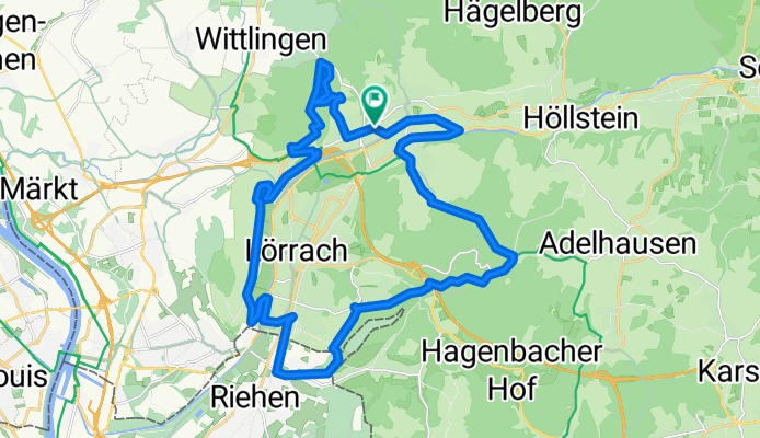
Rund um Lörrach
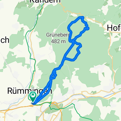
A cycling route starting in Rümmingen, Baden-Wurttemberg, Germany.
Overview
About this route
Around Lörrach, past the adventure climbing park (Lör) and Rötteln Castle, with a short section of singletrail behind the castle, back to Haagen
- -:--
- Duration
- 32.2 km
- Distance
- 559 m
- Ascent
- 509 m
- Descent
- ---
- Avg. speed
- 477 m
- Max. altitude
Route quality
Waytypes & surfaces along the route
Waytypes
Quiet road
12.2 km
(38 %)
Track
11.9 km
(37 %)
Surfaces
Paved
14.5 km
(45 %)
Unpaved
10 km
(31 %)
Asphalt
11.3 km
(35 %)
Gravel
8 km
(25 %)
Continue with Bikemap
Use, edit, or download this cycling route
You would like to ride Rund um Lörrach or customize it for your own trip? Here is what you can do with this Bikemap route:
Free features
- Save this route as favorite or in collections
- Copy & plan your own version of this route
- Sync your route with Garmin or Wahoo
Premium features
Free trial for 3 days, or one-time payment. More about Bikemap Premium.
- Navigate this route on iOS & Android
- Export a GPX / KML file of this route
- Create your custom printout (try it for free)
- Download this route for offline navigation
Discover more Premium features.
Get Bikemap PremiumFrom our community
Other popular routes starting in Rümmingen
 Steady ride in Lörrach
- Distance
- 22.5 km
- Ascent
- 319 m
- Descent
- 398 m
- Location
- Rümmingen, Baden-Wurttemberg, Germany
 Kandern-Glasshütten-Lörach
- Distance
- 48 km
- Ascent
- 442 m
- Descent
- 468 m
- Location
- Rümmingen, Baden-Wurttemberg, Germany
 Hochblauen Tour
- Distance
- 52.4 km
- Ascent
- 1,354 m
- Descent
- 1,354 m
- Location
- Rümmingen, Baden-Wurttemberg, Germany
 Rümmingen - Weil - Kaiseraugst
- Distance
- 22.2 km
- Ascent
- 96 m
- Descent
- 88 m
- Location
- Rümmingen, Baden-Wurttemberg, Germany
 Rund um Lörrach
- Distance
- 32.2 km
- Ascent
- 559 m
- Descent
- 509 m
- Location
- Rümmingen, Baden-Wurttemberg, Germany
 Hausrunde LÖ Haagen
- Distance
- 13.2 km
- Ascent
- 248 m
- Descent
- 246 m
- Location
- Rümmingen, Baden-Wurttemberg, Germany
 Tumringen - Glashütte - Tumringen
- Distance
- 22.8 km
- Ascent
- 441 m
- Descent
- 441 m
- Location
- Rümmingen, Baden-Wurttemberg, Germany
 LÖ Haagen-Hägelberg-Steinen-LÖ
- Distance
- 14 km
- Ascent
- 211 m
- Descent
- 207 m
- Location
- Rümmingen, Baden-Wurttemberg, Germany
Open it in the app