
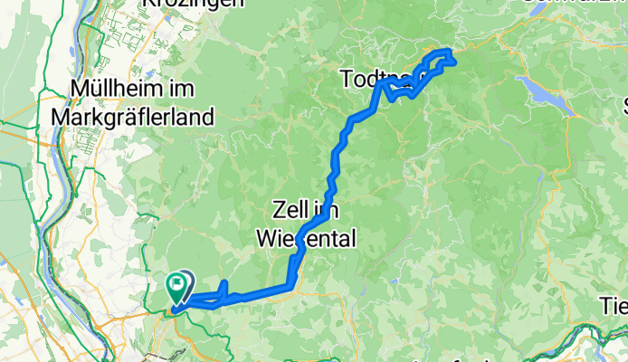
Lörrach-Feldberg-Lörrach
A cycling route starting in Loerrach, Baden-Wurttemberg, Germany.
Overview
About this route
Von Lörrach (Haagen) entlang der Wiese bis nach Todtnau.
Auf`s Hasenhorn mit dem Lift an der Rodelbahn. Dann weiter über den Feldberg und zurück ins Wiesental.
- -:--
- Duration
- 101.2 km
- Distance
- 2,165 m
- Ascent
- 2,127 m
- Descent
- ---
- Avg. speed
- 1,363 m
- Max. altitude
Route quality
Waytypes & surfaces along the route
Waytypes
Track
48 km
(47 %)
Quiet road
22.8 km
(22 %)
Surfaces
Paved
49.9 km
(49 %)
Unpaved
41.3 km
(41 %)
Asphalt
41.1 km
(41 %)
Gravel
29.8 km
(29 %)
Continue with Bikemap
Use, edit, or download this cycling route
You would like to ride Lörrach-Feldberg-Lörrach or customize it for your own trip? Here is what you can do with this Bikemap route:
Free features
- Save this route as favorite or in collections
- Copy & plan your own version of this route
- Split it into stages to create a multi-day tour
- Sync your route with Garmin or Wahoo
Premium features
Free trial for 3 days, or one-time payment. More about Bikemap Premium.
- Navigate this route on iOS & Android
- Export a GPX / KML file of this route
- Create your custom printout (try it for free)
- Download this route for offline navigation
Discover more Premium features.
Get Bikemap PremiumFrom our community
Other popular routes starting in Loerrach
 Lörrach + Alpenrand nach Prien/Chiemsee
- Distance
- 526.1 km
- Ascent
- 5,045 m
- Descent
- 4,801 m
- Location
- Loerrach, Baden-Wurttemberg, Germany
 Lörrach - Adelhausen - Rheinfelden - Weil - Lörrach
- Distance
- 49.8 km
- Ascent
- 288 m
- Descent
- 288 m
- Location
- Loerrach, Baden-Wurttemberg, Germany
 Schöne Tour Lö-Markgräflerland-FR-Lö
- Distance
- 79.1 km
- Ascent
- 590 m
- Descent
- 590 m
- Location
- Loerrach, Baden-Wurttemberg, Germany
 Lörrach-Feldberg-Lörrach
- Distance
- 101.2 km
- Ascent
- 2,165 m
- Descent
- 2,127 m
- Location
- Loerrach, Baden-Wurttemberg, Germany
 Lörrach-Kreuzeiche-Hohe Flum-Lörrach
- Distance
- 41.4 km
- Ascent
- 536 m
- Descent
- 578 m
- Location
- Loerrach, Baden-Wurttemberg, Germany
 Rohl Off
- Distance
- 68.7 km
- Ascent
- 947 m
- Descent
- 947 m
- Location
- Loerrach, Baden-Wurttemberg, Germany
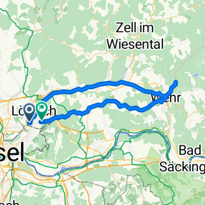 Wiese-Schopfheim-Wehr-Dossenbach-Salzert
- Distance
- 50 km
- Ascent
- 548 m
- Descent
- 469 m
- Location
- Loerrach, Baden-Wurttemberg, Germany
 Von Lörrach in den Naturpark Südschwarzwald, Wiese und Vogelpark Steinen
- Distance
- 36.2 km
- Ascent
- 540 m
- Descent
- 541 m
- Location
- Loerrach, Baden-Wurttemberg, Germany
Open it in the app