RF SMCS: Strömthaler See--Markkleeberger See--Cospudener See--Störmthaler See
A cycling route starting in Rötha, Saxony, Germany.
Overview
About this route
- 1 h 49 min
- Duration
- 47.1 km
- Distance
- 188 m
- Ascent
- 189 m
- Descent
- 25.9 km/h
- Avg. speed
- 152 m
- Avg. speed
Route quality
Waytypes & surfaces along the route
Waytypes
Track
26.8 km
(57 %)
Path
12.6 km
(27 %)
Surfaces
Paved
42.2 km
(90 %)
Unpaved
4.1 km
(9 %)
Asphalt
40.6 km
(86 %)
Gravel
2 km
(4 %)
Continue with Bikemap
Use, edit, or download this cycling route
You would like to ride RF SMCS: Strömthaler See--Markkleeberger See--Cospudener See--Störmthaler See or customize it for your own trip? Here is what you can do with this Bikemap route:
Free features
- Save this route as favorite or in collections
- Copy & plan your own version of this route
- Sync your route with Garmin or Wahoo
Premium features
Free trial for 3 days, or one-time payment. More about Bikemap Premium.
- Navigate this route on iOS & Android
- Export a GPX / KML file of this route
- Create your custom printout (try it for free)
- Download this route for offline navigation
Discover more Premium features.
Get Bikemap PremiumFrom our community
Other popular routes starting in Rötha
- Alte F 95, Großpösna nach Alte F 95, Großpösna
- Distance
- 26.4 km
- Ascent
- 100 m
- Descent
- 102 m
- Location
- Rötha, Saxony, Germany
- Route to Störmthaler See
- Distance
- 9.4 km
- Ascent
- 41 m
- Descent
- 66 m
- Location
- Rötha, Saxony, Germany
- Neuseenland
- Distance
- 106.5 km
- Ascent
- 212 m
- Descent
- 216 m
- Location
- Rötha, Saxony, Germany
- Hafenstraße 1, Großpösna nach Hafenstraße 1, Großpösna
- Distance
- 23.1 km
- Ascent
- 143 m
- Descent
- 149 m
- Location
- Rötha, Saxony, Germany
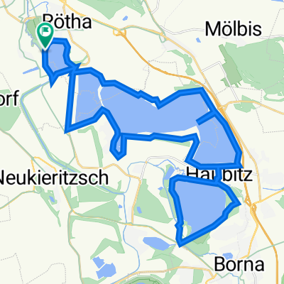
- RK - Cospudener See u. anderer
- Distance
- 62.7 km
- Ascent
- 101 m
- Descent
- 101 m
- Location
- Rötha, Saxony, Germany
- Alte F 95, Großpösna nach Alte F 95, Großpösna
- Distance
- 35.3 km
- Ascent
- 187 m
- Descent
- 186 m
- Location
- Rötha, Saxony, Germany
- Rötha Stausee Rundweg
- Distance
- 4.6 km
- Ascent
- 31 m
- Descent
- 30 m
- Location
- Rötha, Saxony, Germany
- Leipziger Seen Teil 2
- Distance
- 79.9 km
- Ascent
- 120 m
- Descent
- 119 m
- Location
- Rötha, Saxony, Germany
Open it in the app