


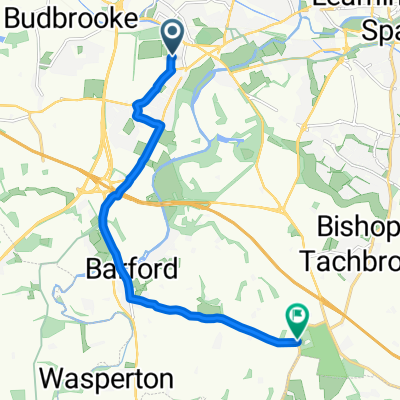
Route 3 (Wasperton Lane)
- 9 km
- 41 m
- 18 m
- Warwick, England, United Kingdom
A cycling route starting in Warwick, England, United Kingdom.
Overview
Start: St. Mary’s Lands/Warwick Racecourse, Warwick.
Finish: Oakley Woods
Route: Warwick Racecourse, Hampton Road, cycle path to Shelley Avenue, Stratford Road, Longbridge M40 cycle path, Bridge Street, Barford, Wasperton Lane, Oakley Woods
created this 4 years ago
Route quality
Quiet road
4.3 km
(48 %)
Cycleway
2.9 km
(32 %)
Paved
5.2 km
(58 %)
Asphalt
4 km
(44 %)
Paved (undefined)
1.3 km
(14 %)
Undefined
3.8 km
(42 %)
Continue with Bikemap
You would like to ride Route 3 (Wasperton Lane) or customize it for your own trip? Here is what you can do with this Bikemap route:
Free trial for 3 days, or one-time payment. More about Bikemap Premium.
Discover more Premium features.
Get Bikemap PremiumFrom our community
Open it in the app


