

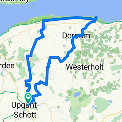
Geesthörn 15, Upgant-Schott nach Geesthörn 15, Upgant-Schott
A cycling route starting in Marienhafe, Lower Saxony, Germany.
Overview
About this route
- 2 h 38 min
- Duration
- 38.7 km
- Distance
- 88 m
- Ascent
- 90 m
- Descent
- 14.7 km/h
- Avg. speed
- ---
- Max. altitude

Route photos

Route quality
Waytypes & surfaces along the route
Waytypes
Quiet road
22.1 km
(57 %)
Path
10.5 km
(27 %)
Surfaces
Paved
12.8 km
(33 %)
Unpaved
0.8 km
(2 %)
Asphalt
12.8 km
(33 %)
Ground
0.8 km
(2 %)
Undefined
25.2 km
(65 %)
Continue with Bikemap
Use, edit, or download this cycling route
You would like to ride Geesthörn 15, Upgant-Schott nach Geesthörn 15, Upgant-Schott or customize it for your own trip? Here is what you can do with this Bikemap route:
Free features
- Save this route as favorite or in collections
- Copy & plan your own version of this route
- Sync your route with Garmin or Wahoo
Premium features
Free trial for 3 days, or one-time payment. More about Bikemap Premium.
- Navigate this route on iOS & Android
- Export a GPX / KML file of this route
- Create your custom printout (try it for free)
- Download this route for offline navigation
Discover more Premium features.
Get Bikemap PremiumFrom our community
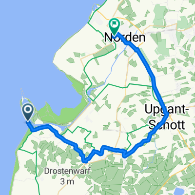
Other popular routes starting in Marienhafe
 Geesthörn 15, Upgant-Schott nach Geesthörn 15, Upgant-Schott
- Distance
- 33.5 km
- Ascent
- 68 m
- Descent
- 70 m
- Location
- Marienhafe, Lower Saxony, Germany
 Langsame Fahrt in Marienhafe
- Distance
- 7.7 km
- Ascent
- 0 m
- Descent
- 0 m
- Location
- Marienhafe, Lower Saxony, Germany
 GPX Download: Schattige Waldwege – Wunderschöne Aussicht Runde von Marienhafe - GPX Download: Schattige Waldwege – Wunderschöne Aussicht Runde von Marienhafe
- Distance
- 56.3 km
- Ascent
- 28 m
- Descent
- 29 m
- Location
- Marienhafe, Lower Saxony, Germany
 Geesthörn 15, Upgant-Schott nach Geesthörn 15, Upgant-Schott
- Distance
- 38.7 km
- Ascent
- 88 m
- Descent
- 90 m
- Location
- Marienhafe, Lower Saxony, Germany
 Upgant-Schott, Hage, Neßmersiel, Dornumersiel, Dornumersiel, Arle, Grossheide, Marienhafe
- Distance
- 65.1 km
- Ascent
- 146 m
- Descent
- 148 m
- Location
- Marienhafe, Lower Saxony, Germany
 Marienhafe, Berumerfehn, Arle, Nesse, Neßmersiel, Ostermarsch, Lütetsburg, Halbmond, Marienhafe
- Distance
- 62.8 km
- Ascent
- 168 m
- Descent
- 168 m
- Location
- Marienhafe, Lower Saxony, Germany
 Windmühlen 55 km
- Distance
- 55.6 km
- Ascent
- 8 m
- Descent
- 8 m
- Location
- Marienhafe, Lower Saxony, Germany
 Marienhafe - Holtgast
- Distance
- 34 km
- Ascent
- 29 m
- Descent
- 29 m
- Location
- Marienhafe, Lower Saxony, Germany
Open it in the app