
Werribee Gorge Circuit - walk
A cycling route starting in Bacchus Marsh, Victoria, Australia.
Overview
About this route
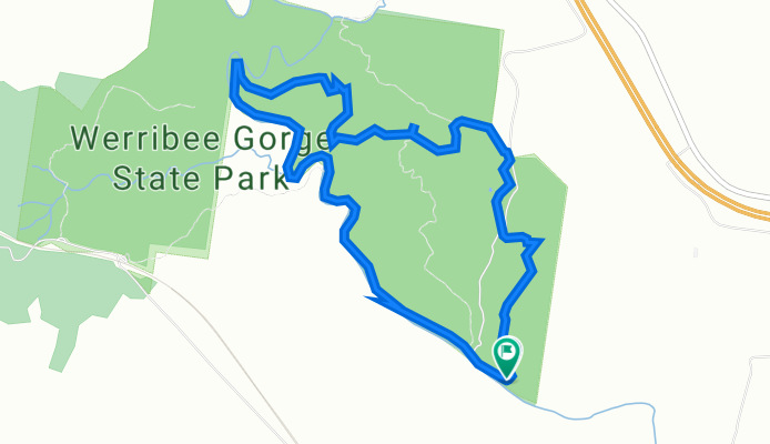
Head anti-clockwise. Takes approximately 4 hours. Difficulty is medium. Total is around 10 km.
- -:--
- Duration
- 7.9 km
- Distance
- 412 m
- Ascent
- 413 m
- Descent
- ---
- Avg. speed
- 351 m
- Max. altitude

Route highlights
Points of interest along the route
Point of interest after 0 km
Miekles Point Picnic Area (start)
Point of interest after 0 km
Carpark
Point of interest after 1.2 km
Carpark
Point of interest after 1.4 km
Quarry Picnic Area Carpark - can start walk from here also.
Point of interest after 1.6 km
Carpark
Point of interest after 1.7 km
Myers Road Trailhead
Point of interest after 2 km
Werribee old farm site
Point of interest after 2.1 km
Centenary Track Trailhead
Point of interest after 2.5 km
Short Circuit Track Trailhead
Point of interest after 2.6 km
Eastern Viewpoint
Point of interest after 3.2 km
Picnic Point
Point of interest after 3.7 km
Western Viewpoint
Point of interest after 4.5 km
Blackwood Pool
Point of interest after 5.5 km
Needles Beach
Point of interest after 6.1 km
Lionhead Beach
Point of interest after 6.9 km
Werribee Gorge
Point of interest after 7.5 km
Short Circuit Track Trailhead
Point of interest after 7.7 km
Miekles Point Picnic Area
Continue with Bikemap
Use, edit, or download this cycling route
You would like to ride Werribee Gorge Circuit - walk or customize it for your own trip? Here is what you can do with this Bikemap route:
Free features
- Save this route as favorite or in collections
- Copy & plan your own version of this route
- Sync your route with Garmin or Wahoo
Premium features
Free trial for 3 days, or one-time payment. More about Bikemap Premium.
- Navigate this route on iOS & Android
- Export a GPX / KML file of this route
- Create your custom printout (try it for free)
- Download this route for offline navigation
Discover more Premium features.
Get Bikemap PremiumFrom our community
Other popular routes starting in Bacchus Marsh
 Lerderderg trail
- Distance
- 46.6 km
- Ascent
- 651 m
- Descent
- 182 m
- Location
- Bacchus Marsh, Victoria, Australia
 Brisbane Ranges Loop 1
- Distance
- 83 km
- Ascent
- 500 m
- Descent
- 497 m
- Location
- Bacchus Marsh, Victoria, Australia
 Bacchus marsh to ballan
- Distance
- 26.1 km
- Ascent
- 469 m
- Descent
- 55 m
- Location
- Bacchus Marsh, Victoria, Australia
 Mount Sugarloaf
- Distance
- 19.1 km
- Ascent
- 420 m
- Descent
- 244 m
- Location
- Bacchus Marsh, Victoria, Australia
 Werribee Vale Road
- Distance
- 11.1 km
- Ascent
- 60 m
- Descent
- 61 m
- Location
- Bacchus Marsh, Victoria, Australia
 Lord Street 20B, Bacchus Marsh to Natasha Close 4, Darley
- Distance
- 6.4 km
- Ascent
- 260 m
- Descent
- 45 m
- Location
- Bacchus Marsh, Victoria, Australia
 day one option A overnight
- Distance
- 109 km
- Ascent
- 1,207 m
- Descent
- 799 m
- Location
- Bacchus Marsh, Victoria, Australia
 Werribee Gorge State Park Quarry Picnic Area to Station
- Distance
- 12.2 km
- Ascent
- 197 m
- Descent
- 298 m
- Location
- Bacchus Marsh, Victoria, Australia
Open it in the app