

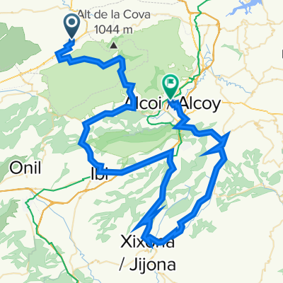
Bocairent-Agres-OF Teix-Muro-VV Yecla
A cycling route starting in Bocairent, Valencia, Spain.
Overview
About this route
- -:--
- Duration
- 47.7 km
- Distance
- 921 m
- Ascent
- 924 m
- Descent
- ---
- Avg. speed
- ---
- Max. altitude

Route quality
Waytypes & surfaces along the route
Waytypes
Access road
23.4 km
(49 %)
Quiet road
19.1 km
(40 %)
Surfaces
Paved
2.4 km
(5 %)
Unpaved
18.6 km
(39 %)
Ground
10.5 km
(22 %)
Gravel
8.1 km
(17 %)
Continue with Bikemap
Use, edit, or download this cycling route
You would like to ride Bocairent-Agres-OF Teix-Muro-VV Yecla or customize it for your own trip? Here is what you can do with this Bikemap route:
Free features
- Save this route as favorite or in collections
- Copy & plan your own version of this route
- Sync your route with Garmin or Wahoo
Premium features
Free trial for 3 days, or one-time payment. More about Bikemap Premium.
- Navigate this route on iOS & Android
- Export a GPX / KML file of this route
- Create your custom printout (try it for free)
- Download this route for offline navigation
Discover more Premium features.
Get Bikemap PremiumFrom our community
Other popular routes starting in Bocairent
 Serra Mariola
- Distance
- 30.5 km
- Ascent
- 526 m
- Descent
- 527 m
- Location
- Bocairent, Valencia, Spain
 Bocairent - Alcoy
- Distance
- 93.7 km
- Ascent
- 1,909 m
- Descent
- 1,993 m
- Location
- Bocairent, Valencia, Spain
 Bocairent - Villalonga
- Distance
- 61.5 km
- Ascent
- 638 m
- Descent
- 716 m
- Location
- Bocairent, Valencia, Spain
 2de etappe GravelCid Bocairent - Ontinyent
- Distance
- 46.2 km
- Ascent
- 480 m
- Descent
- 907 m
- Location
- Bocairent, Valencia, Spain
 5 Bocairen-Mariola-Gandia1 75km
- Distance
- 76.1 km
- Ascent
- 813 m
- Descent
- 1,420 m
- Location
- Bocairent, Valencia, Spain
 Rondrit vanuit Bocairent
- Distance
- 57.2 km
- Ascent
- 983 m
- Descent
- 984 m
- Location
- Bocairent, Valencia, Spain
 17/09 Bocairent-Col de Rates-Calpe
- Distance
- 104.9 km
- Ascent
- 1,932 m
- Descent
- 2,560 m
- Location
- Bocairent, Valencia, Spain
 Bocairent - (Guilella) - Banyeres - (serra) - Biar - La Canyada - Beneixama - Bocairent
- Distance
- 59.8 km
- Ascent
- 646 m
- Descent
- 623 m
- Location
- Bocairent, Valencia, Spain
Open it in the app