

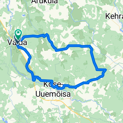
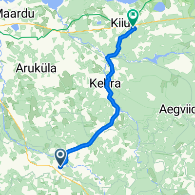
Oja, Kose to Oja, Kose
A cycling route starting in Vaida, Harju, Estonia.
Overview
About this route
- 1 h
- Duration
- 19 km
- Distance
- 49 m
- Ascent
- 51 m
- Descent
- 19.1 km/h
- Avg. speed
- ---
- Max. altitude

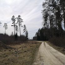
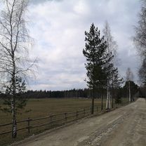
Route photos


Route quality
Waytypes & surfaces along the route
Waytypes
Quiet road
8.4 km
(44 %)
Cycleway
5.5 km
(29 %)
Surfaces
Paved
8.5 km
(45 %)
Asphalt
8.5 km
(45 %)
Undefined
10.4 km
(55 %)
Continue with Bikemap
Use, edit, or download this cycling route
You would like to ride Oja, Kose to Oja, Kose or customize it for your own trip? Here is what you can do with this Bikemap route:
Free features
- Save this route as favorite or in collections
- Copy & plan your own version of this route
- Sync your route with Garmin or Wahoo
Premium features
Free trial for 3 days, or one-time payment. More about Bikemap Premium.
- Navigate this route on iOS & Android
- Export a GPX / KML file of this route
- Create your custom printout (try it for free)
- Download this route for offline navigation
Discover more Premium features.
Get Bikemap PremiumFrom our community
Other popular routes starting in Vaida
 Oja, Kose to Alu 21, Kose
- Distance
- 14.9 km
- Ascent
- 12 m
- Descent
- 13 m
- Location
- Vaida, Harju, Estonia
 Oja, Kose to Oja, Kose
- Distance
- 19 km
- Ascent
- 49 m
- Descent
- 51 m
- Location
- Vaida, Harju, Estonia
 Route in Rae vald
- Distance
- 104.7 km
- Ascent
- 332 m
- Descent
- 312 m
- Location
- Vaida, Harju, Estonia
 Route in Rae vald
- Distance
- 55.1 km
- Ascent
- 152 m
- Descent
- 155 m
- Location
- Vaida, Harju, Estonia
 Kose-Kuusalu
- Distance
- 42.3 km
- Ascent
- 82 m
- Descent
- 100 m
- Location
- Vaida, Harju, Estonia
 Kose-Paunküla
- Distance
- 68.4 km
- Ascent
- 78 m
- Descent
- 80 m
- Location
- Vaida, Harju, Estonia
 Karla to Karla
- Distance
- 11.1 km
- Ascent
- 50 m
- Descent
- 49 m
- Location
- Vaida, Harju, Estonia
 Oru Fast ring - 20 km
- Distance
- 19.6 km
- Ascent
- 88 m
- Descent
- 86 m
- Location
- Vaida, Harju, Estonia
Open it in the app